
THE WORLD'S MOST ENDANGERED MARINE MAMMAL NEEDS YOUR HELP
 Concepts of Thinking: Interrelationships, Geographic Perspective, Spatial Significance
Inquiry: How has the vaquita become so endangered? How might this species be protected.
Activity: Gather data on the vaquita. Conduct an issue analysis to evaluate perspectives. Develop a plan and communicate it to the appropriate audience via story map.
CBC IN SOUTH SUDAN
|
|
Concepts of Thinking: Interrelationships, Geographic Perspective, Spatial Significance
Inquiry: How has the vaquita become so endangered? How might this species be protected.
Activity: Gather data on the vaquita. Conduct an issue analysis to evaluate perspectives. Develop a plan and communicate it to the appropriate audience via story map.
CBC IN SOUTH SUDAN
'They are killing civilians house to house': Crowded UN camp filled with horror stories
 Concepts of Thinking: Interrelationship, Geographic Perspective, Spatial Significance
Inquiry: How might this crisis be resolved? What might be the final straw before powers that can actually do something to help solve this crisis?
Activity: Gather data and information on the crisis. Conduct an issue analysis to help develop a plan to solve this situation. Communicate results to an appropriate audience via story map.
Scientists have discovered vast systems of flowing water in Antarctica. And that worries them. By Chelsea Harvey
 Concepts of Thinking: Patterns and Trends, Interrelationships, Spatial Significance
Inquiry: How might these rivers impact the ecosystem of Antarctica? What might be the global implications of these rivers?
Activity: Conduct an issue analysis and gather information on the ice flows. Make predictions from the data and communicate action to an appropriate audience via story map.

Concepts of Thinking: Interrelationship, Geographic Perspective, Spatial Significance
Inquiry: How might this crisis be resolved? What might be the final straw before powers that can actually do something to help solve this crisis?
Activity: Gather data and information on the crisis. Conduct an issue analysis to help develop a plan to solve this situation. Communicate results to an appropriate audience via story map.
Scientists have discovered vast systems of flowing water in Antarctica. And that worries them. By Chelsea Harvey

Receding glacier causes immense Canadian river to vanish in four days Hannah Devlin
 Concepts of Thinking: Patterns and Trends, Interrelations, Spatial Significance
Inquiry: How might this drastic change impact communities.
Activity: Gather landform data of river basins feed by glaciers. Create models of predicted basin change due to increased glacier melt. Conduct an issue analysis and communicate results to an appropriate audience via story map.
 Concepts of Thinking: Patterns and Trends, Interrelations, Spatial Significance
Famine Threatening 20 Million People
April 12, 2017
 Concepts of Thinking: Interrelationships, Spatial Significance, Geographic Perspective, Patterns and Trends
Inquiry: Why might famine still be a major problem for the World with current food production capabilities?
Activity: Gather information on the current and past famines. Conduct an issue analysis of a current famine to develop a strategy that may prevent future famines. Communicate to an appropriate audience via story map.

Geology and seepage in the NE Atlantic region GEERT-JAN VIS
 Concepts of Thinking: Spatial Significance, Patterns and Trends, Interrelationship
Inquiry: Why is seepage happening? How might the seepage impact communities in the North Atlantic and other parts of the world?
Activity: Gather data on seepage in the North Atlantic and create a spatial journal. Conduct an issue analysis and make prediction and develop a plan to deal with the situation. Communicate via story map to an appropriate audience.
Geology and seepage in the NE Atlantic region GEERT-JAN VIS

Syria chemical weapons attack toll rises to 70 as Russian narrative dismissed
 Concepts of Thinking: Interrelationships, Spatial Significance, Geographic Perspective
Inquiry: What is required for this on going Genocide to stop? Why is it hat countries that can actually do something to save lives seem to be just watching?
Activity: Conduct an issue analysis examining the values and beliefs of the stakeholders and develop a plan to save lives. Communicate your plan to the United Nations via story map.
 Concepts of Thinking: Interrelationships, Spatial Significance, Geographic Perspective
Famine crisis: 4 countries that need help
 Concepts of Thinking: Spatial Significance, Patterns and Trends
Inquiry: How might this issue be resolved so it does not happen again, here or elsewhere?
Activity: Conduct an issue analysis. Create an annotated map of the stakeholders. Evaluate stakeholders values and beliefs and develop a possible solution that can be communicated to an appropriate audience via story map.

Concepts of Thinking: Spatial Significance, Patterns and Trends
Inquiry: How might this issue be resolved so it does not happen again, here or elsewhere?
Activity: Conduct an issue analysis. Create an annotated map of the stakeholders. Evaluate stakeholders values and beliefs and develop a possible solution that can be communicated to an appropriate audience via story map.
Sea Ice Extent Sinks to Record Lows at Both Poles Maria-José Viñas NASA's Earth Science News Team

Concepts of Thinking: Patterns and Trends, Spatial Significance, Interrelationships, Geographic Perspective
Inquiry: How might communities in the north and south be impacted by the loss of sea ice? How can communities prepare for this loss?
Activity: Conduct an issue analysis to determine possible action that might be required. Communicate results via story map to the appropriate authorities.

Oceans at Risk


Concepts of Thinking: Spatial Significance, Geographic Perspective
Inquiry: How might different stakeholder ensure the survival of the oceans?
Activity: Create an annotated map of active stakeholders and what they are doing. Conduct an issue analysis. Develop of plausible solution to the issue and communicate via story map.
Syrian children 'pushed to the brink' after worst atrocities since war began
 Concepts of Thinking: Interrelationships, Patterns and Trends, Geographic Perspective
Inquiry: What might the future for these kids be if the "World" continues to do nothing?
Activity: Gather and organize information regarding how Syrian children are being affected by the current conflict. Conduct an issue analysis to determine possible future for the Children of Syria. Why might countries not have been able to help the children to date? Communicate solution, via story map, to the appropriate authorities and ask for a response.

Past Disasters Reveal Terrifying Future of Climate Change
PUBLISHED

PUBLISHED

Oil price will soar without investment in capacity, says watchdog

Concepts of Thinking: Spatial Significance, Interrelationships, Patterns and Trends, Geographic Perspective
Inquiry: How might this impact the Canadian Economy? How might this impact consumers?
Activity: Create an annotated map of oil infrastructure. Create graphs of oil prices to determine trends. Add information of global issues i.e. conflict/government policy etc. Conduct an issue analysis to help determine a possible solution and communicate via story map.
New map reveals the world’s most toxic countries by Lacy Cooke
 Concpets of Thinking: Patterns and Trends, Spatial Significance
Inquiry: Why do these countries have the toxic levels they do? How might countries best reduce their levels?
Activity: Gather information of toxicity. Conduct an issue analysis and determine what might be done to reduce levels. Communicate results to the appropriate audience via story map.
Concepts of Thinking: Spatial Significance, Interrelationships, Patterns and Trends, Geographic Perspective
Inquiry: How might this impact the Canadian Economy? How might this impact consumers?
Activity: Create an annotated map of oil infrastructure. Create graphs of oil prices to determine trends. Add information of global issues i.e. conflict/government policy etc. Conduct an issue analysis to help determine a possible solution and communicate via story map.
New map reveals the world’s most toxic countries by Lacy Cooke

Donald Trump says US not committed to two-state Israel-Palestine solution

Concepts of Thinking: Interrelationships, Geographic Perspective, Spatial Significance
Inquiry: How might Trumps position on a possible solution impact regions?
Activity: Identify the stakeholders and then conduct an issue analysis of the situation. Develop a possible solution and communicate to the appropriate audience via story map.

Extraordinary' levels of pollutants found in 10km deep Mariana trench Damian Carrington
Concepts of Thinking: Interrelationships, Spatial Significance
Inquiry: Why might these toxins be of concern?
Activity: Gather information on ocean pollutants and create a spatial journal of the sources. Conduct an issue analysis to develop a possible course of action and communicate to appropriate audience via story map.

Trump agrees to support 'One China' policy in Xi Jinping call Tom Phillips in Beijing
 Concepts of Think: Interrelationships, Patterns and Trends
Inquiry: Why might Trump support a "questionable" population policy that China got phased out in 2015?
Activity: Conduct an investigation on other population policies and create a spatial journal. Complete an issue analysis of the China's current and possible future policies. Determine how to proceed and communicate results via story map.

Cultural evolution and the mutilation of women
 Concepts of Thinking: Interrelationships, Spatial Significance,
Inquiry: How might this movement impact societies?
Activity: Create a spatial journal and observe for patterns. Complete an issue analysis of the issue and communicate possible solutions via story map. Communicate to appropriate audience.
 Concepts of Thinking: Interrelationships, Spatial Significance,
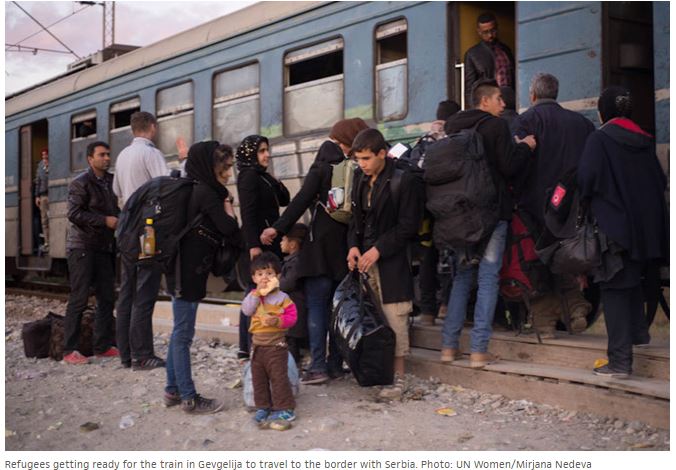
UN Women assesses the needs of women migrants and refugees in Serbia and fYR Macedonia
 Concepts of Thinking: Interrelationships, Spatial Significance, Patterns and Trends, Geographic Perspective
Inquiry: How might the needs of refugee women be better addressed?
Activity: Gather data regarding refugee needs. Complete an issue analysis to develop a possible solution. Communicate the solution with the appropriate audience via story map.
9 maps and charts that explain the global refugee crisis Updated by
 Concepts of Thinking: Spatial Significance, Patterns and Trends, Geographic Perspective
Inquiry: Why might so many people feel they have to leave their homeland? How might this trend be reversed?
Activity: Create a spatial journal of where people are leaving and where they are going to. Add to the map the reasons. Conduct an issue analysis of one region and develop a a possible solution. How might your solution apply to other regions? Communicate via story map.

These Countries with Business Links to Trump Aren’t Part of His Immigration Ban
 Concepts of Thinking: Patterns and Trends, Geographic Perspective, Spatial Significance
Inquiry: How might the Presidents business dealings impact the safety of this region?
Activity: Create a spatial journal of the area to document what has and is happening in these countries. Conduct an issue analysis of the conflict of interest in this region. Develop a possible solution and communicate solution via story map to the appropriate audience.

NASA Study Shows Global Sea Ice Diminishing, Despite Antarctic Gains
 Concepts of Thinking: Spatial Significance, Patterns and Trends
Inquiry: How might the difference in sea ice impact communities around the world? How might this loss of ice best be addressed?
Activity: Gather data regarding sea ice. Chart information and observe possible patters and trends. Create maps or access maps showing sea ice. How might spatial significance impact sea ice? What should be done to help maintain the sea ice? Create a story map to communicate results.

The war on baby girls winds down The Economist

Concepts of Thinking: Patterns and Trends, Spatial Significance,
Inquiry: How might this change impact communities? Why might it have taken this long for views to change?
Activity: Gather data on sex ratios around the world and create an annotated map. Observe any patterns. Evaluate and draw conclusion regard this trend. Communicate

Flooding More Than Doubled Across Europe in 35 Years By Arthur Neslen, The Guardian
 Concepts of Thinking: Spatial Significance, Patterns and Trends, Interrelationships
Inquiry: How might communities deal with this increase in flooding? What might the next 35 years look like?

What if the fighting in Aleppo was happening in Toronto?

Concepts of Thinking: Spatial Significance, Geographic Perspective, Interrelationships
Inquiry: What should be done to stop this Genocide? How might citizens end this Genocide because Governments aren't willing to do what needs to be done even after Yugoslavia, Rwanda, and the Sudan. What might this world look like if the powers that should don't?
Activity: Understand the issues by completing an issue analysis. Use the conversational and sensitive document to help deliver with delivery of the topic. Create a story map and share with appropriate audience to cause change.

Aleppo’s people are being slaughtered. Did we learn nothing from Srebrenica?

The world’s wet regions are getting wetter and the dry regions are getting drier

Concepts of Thinking: Patterns and Trends, Spatial Significance, Interrelationships
Inquiry: How might this pattern impact different communities around world.
Activity: Gather and organize the data and create a graph to interpret and evaluate the data. What prediction might be made? Create an annotated map to show where these evens are most likely to occur. Observe the map to determine the spatial significance of places impacted the most. Conduct an issue analysis to help evaluate for interrelationships. Communicate via story map.

CIA concludes Russia interfered to help Trump win election, say reports
Damien Gayle and agencies
 Concepts of Thinking: Geographic Perspective, Interrelationships
Inquiry: What might be to fallout of these findings?
Activity: Conduct an issue analysis on the situation. Create an annotated map if the stakeholders. Determine possible outcomes and communicate via story map.

Warming U.S. Could See Extreme Rains Increase Fivefold
By Andrea Thompson

Concepts of Thinking: Spatial Significance,
Patterns and Trends, Interrelationships
Inquiry: How might this impact Canadians?
Activity: Gather information on climate in Canada. Create an annotated map of the different regions in Canada. Conduct an issue analysis to come up with a plan to deal with any changes that might occur. Communicate via story map.
30 Years of Oil and Gas Pipeline Accidents, Mapped

Concepts of Thinking: Spatial Significance, Interrelationships, Patterns and Trends, Geographic Perspective
Inquiry: What might be the best location and method to transport fossil fuels? How might such accidents involving fossil fuel infrastructure be minimized? How might a better alternative to fossil fuels be distributed?
Activity: Conduct a Geographic inquiry to develop an alternative. Gather data on fossil fuel disasters and observe any patterns that may appear. Conduct an issue analysis to better understand the problem. Create an annotated map to show communities impacted by this type of infrastructure. Communicate results via story map.

Fake news tries to blame human-caused global warming on El Niño

Concepts of Thinking: Interrelationships, Geographic Perspective
Inquiry: How might people better protect themselves from fake news? How might fake news impact national policies? How might the spread of fake news impact others?
Activity: Gather information on fake news. Complete a Venn diagram to help determine the difference between fake, satire, and real news. Conduct an issue analysis to develop a possible solution. Communicate to an appropriate audience the concerns and solutions to the spread of fake news.

Concepts of Thinking: Interrelationships, Geographic Perspective
Standing Rock: US denies key permit for Dakota Access pipeline, in win for tribe
 Concepts of Thinking: Spatial Significance, Geographic Perspective, Interrelationships, Patterns and Trends
Inquiry: What might have been the reason why the government changed the location in the first place? How might the government proceed in determining an appropriate location for the pipeline?
Activity: Determine the characteristics of an appropriate site for the pipeline. Create an annotated map of the possibilities. Conduct an issue analysis to and determine a possible solution. Communicate via story map to an appropriate audience.

OPEC agrees first output cut since 2008; Saudis open to ‘big hit’, but details still unclear Ahmad Ghaddar, Alex Lawler and Rania El Gamal, Reuters
 Concepts of Thinking: Geographic Perspective, Interrelationships, Spatial Significance, Patterns and Trends
Inquiry: Who might these restrictions impact Canadians? Why might OPEC countries be willing to cut oil production?
Activity: Create an annotated map of OPEC countries and countries that import oil to. Observe for patterns and trends. Conduct an issue analysis to help evaluate the consequences of this reduction. Develop a plan to account for this project cuts and communicate via story map.

Inquiry: Who might these restrictions impact Canadians? Why might OPEC countries be willing to cut oil production?
Shrinking glaciers cause state-of-emergency drought in Bolivia
Jan Rocha for Climate News Network, part of the Guardian Environment Network
 Concepts of Thinking: Interrelationships, Spatial Significance, Geographic Perspective
Inquiry: How might this situation impact surrounding nations?
Activity: Create an annotated map of the glaciers in the region and the countries that depend on them. Conduct an issue analysis to help develop a solution to the problem. Communicate findings via story map to an appropriate audience.
Bolivians in La Paz fetch water from a tanker truck provided by officials of the Bolivian public water company, Epsas. Photograph: Martin Alipaz/EPA

An ugly homicide number we need to discuss
Scott Gilmore November 25, 2016
 Concepts of Thinking: Interrelationships, Geographic Perspective, Patterns and Trends, Spatial Significance
Inquiry: Why might Indigenous homicide rates be so high in the far north? What might be needed to reduce these rates?
Activity: Conduct an issue analysis to determine the views that might be contributing to the problem. Create an annotated map of collected data to illustrate the problem. Develop a solution and communicate via story map to an appropriate audience.

Shipping maps win at the Information Is Beautiful Awards
 Concepts of Thinking: Spatial Significance, Patterns and Trends,
Inquiry: How might this data be used by different stakeholders?
Activity: Gather information on the destination ports. Create graphs to indicate how the volume of transport. Create an annotated map for analysis and or developing more inquiry questions for exploration. Communiacte finding via story map.

Big oil v orcas: Canadians fight pipeline that threatens killer whales on the brink

Concepts of Thinking: Interrelationships, Spatial Significance, Geographic Perspective
Inquiry: What might be the best way to meet the need for oil and meet the need for conservation?
Activity: Use the concepts of thinking graphic organizers and conduct an issue analysis. Use this information to create a spatial journal to decide on how to move forward. Develop a story map to communicate to an appropriate audience.

Conservation Decisions Must Protect the Livelihoods of People Living in Africa
By: Ross Harvey
 Concepts of Thinking: Spatial Significance, Interrelationships, Geographic Perspective, Patterns and Trends
Inquiry: How might conservation interact with development?
Activity: Conduct an issue analysis of one of the concerns in the reading. Use the concepts of thinking graphic organizers to clarify the problem. Create a spatial journal of different concerns. Develop a resolution and then communicate via story map to an appropriate audience.

How other countries would vote in the American election
 Concepts of Thinking: Spatial Significance, Geographic Perspective, Interrelationships, Patterns and Trends
Inquiry: How might this world view impact how Trump leads?
Activity: Conduct an issue analysis and create a spatial journal of the countries views. Create a story map to communicate results to an appropriate audience

Photo of the Day National Geographic
 Concepts of Thinking: Spatial Significance, Interrelationships, Geographic Perspective, Patterns and Trends
Inquiry: Where might these photos have been taken. Why might these photos have been taken?
Activity: Examine the photos and develop inquiry questions that might be used for each of the photos. Try to answer the questions and communicate.
Every year, nearly 1.3M people die in traffic accidents.
 Concepts of Thinking: Patterns and Trends, Spatial Significance
Inquiry: How might car fatalities be stopped globally?
Activity: Gather data to create a spatial journal of car fatalities. What might account for any patterns and trends that can be observed? Conduct an issue analysis of the issue. Communicate via story map.

Concepts of Thinking: Spatial Significance, Interrelationships, Geographic Perspective, Patterns and Trends
Inquiry: Where might these photos have been taken. Why might these photos have been taken?
Activity: Examine the photos and develop inquiry questions that might be used for each of the photos. Try to answer the questions and communicate.
Every year, nearly 1.3M people die in traffic accidents.

Oil may hit ‘low-$40s’ if OPEC fails to deliver quota deal: Goldman Sachs Ben Sharples, Bloomberg News
 Concepts of Thinking: Interrelationships, Spatial Significance, Geographic Perspective, Patterns and Trends
Inquiry: How might the change in oil prices impact Canadians?
Activity: Gather data on world oil prices and the global economy. Create a spatial journal of key events. Make predictions as to what now might happen and communicate via a story map.

Inquiry: How might the change in oil prices impact Canadians?
Italy earthquake: 6.6-magnitude tremor rocks nation's center
 Concepts of Thinking: Spatial Significance, Patterns and Trends, Interrelationships
Inquiry: How could people prepare for such an event?
Activity: Create a spatial journal of past earth quakes in the region (patterns and trends). Conduct an issue analysis to develop possibilities to help the region. Communicate via story map.

Global Gender Pay Gap Won't Close For 170 Years: Report By The Associated Press
 Concepts of Thinking: Patterns and Trends, Spatial Significance, Geographic Perspective
Inquiry: What might be necessary to create a situation where women and men earn the salary for the same work?
Activity: Create a spatial journal of the countries and the percentage gap they hold. Observe for patterns and trends and develop a strategy that might help improve the situation for women so that they can actually earn the same. Communicate the strategy via story map.

The Migration of Anatomically Modern Humans
 Concepts of Thinking; Spatial Significance, Patterns and Trends
Inquiry:Why might people have migrated? How might people have traveled? Why did people choose their routes? How might these routes relate to current migration routes?
Activity: Gather data on current migration (An other source). Create a proportional width arrow map indicating routes and numbers. Conduct an issue analysis and develop predictions to help meet the needs of future migrants. Communicate via story map.

Delhi airport first carbon neutral airport in Asia-Pacific Press Trust of India | New Delhi

Concepts of Thinking: Geographic Perspective, Spatial Significance, Patterns and Trends, Interrelationships
Inquiry: How might other airports react to this event?
Activity: Create a spatial journal of the airports in the region. Investigate how airports might be concerned with the environment. Conduct an issue analysis to determine how more airports could be carbon neutral. Communicate suggestions via story map.
 Concepts of Thinking: Interrelationships, Geographic Perspective, Patterns ad Trends
Inquiry: How might women be able to impact past farming practice?
Activity: Create a spatial journal of places around the world that have incorporated the women's perspective and compare that with areas that haven't. Can any patterns be observed? What may account for these patterns? What might be needed to get more places to incorporate women's perspective? What other social areas could be positively impacted by listening and incorporating women's perspective? Communicate finding via story map.


Concepts of Thinking: Interrelationships, Geographic Perspective, Patterns ad Trends
Inquiry: How might women be able to impact past farming practice?
Activity: Create a spatial journal of places around the world that have incorporated the women's perspective and compare that with areas that haven't. Can any patterns be observed? What may account for these patterns? What might be needed to get more places to incorporate women's perspective? What other social areas could be positively impacted by listening and incorporating women's perspective? Communicate finding via story map.
Second Harvest Turns Food Waste Into 22,000 Free Meals A Day
 Concepts of Thinking: Geographic Perspective, Patterns and Trends
Inquiry: Why might there be so much waste of food? How can people reduce their waste? What might be required to help reduce the number of people going hungry?
Activity: Conduct some research on hunger in Canada and the world. Create a spatial journal of food waste and hunger are there any patterns and trends that can be observed. Conduct an issue analysis to determine possible solutions and communicate via story map.

Concepts of Thinking: Geographic Perspective, Patterns and Trends
Inquiry: Why might there be so much waste of food? How can people reduce their waste? What might be required to help reduce the number of people going hungry?
Activity: Conduct some research on hunger in Canada and the world. Create a spatial journal of food waste and hunger are there any patterns and trends that can be observed. Conduct an issue analysis to determine possible solutions and communicate via story map.
Expect a warmer-than-normal fall, says Environment Canada
 Concepts of Thinking: Spatial Significance, Patterns and Trends, Interrelationship, Geographic Perspective
Inquiry: What might the warmer fall impact look like? How could this weather impact different populations?
Activity: Research weather patterns in Canada. Create a spatial journal of weather from past to present. How might meteorologist be able to predict the weather How does this current weather prediction fit in? Make predictions of impacts based on the climate predictions. Communicate predictions and possible actions required via story map to an appropriate audience.

Concepts of Thinking: Spatial Significance, Patterns and Trends, Interrelationship, Geographic Perspective
Inquiry: What might the warmer fall impact look like? How could this weather impact different populations?
Activity: Research weather patterns in Canada. Create a spatial journal of weather from past to present. How might meteorologist be able to predict the weather How does this current weather prediction fit in? Make predictions of impacts based on the climate predictions. Communicate predictions and possible actions required via story map to an appropriate audience.
ENDANGERED SPECIES: WHY SHOULD I CARE? ·

Brazil ratification pushes Paris climate deal one step closer. Jeff Tollefson
 Concepts of Thinking: Geographic Perspective, Interrelationship, Spatial Significance, Patterns and Trends
Inquiry: How might Brazil's ratification impact Paris climate deal?
Activity: Conduct an issue analysis of the Paris accord. Create a spatial journal of countries involved. Create a story map to communicate to an appropriate audience the impacts of Brazil's ratification.

Concepts of Thinking: Geographic Perspective, Interrelationship, Spatial Significance, Patterns and Trends
Inquiry: How might Brazil's ratification impact Paris climate deal?
Activity: Conduct an issue analysis of the Paris accord. Create a spatial journal of countries involved. Create a story map to communicate to an appropriate audience the impacts of Brazil's ratification.
Canadian Economy Needs 10, 15 Years To Reinvent Itself, RBC CEO Says
 Concepts of Thinking: Patterns and Trends, Geographic Perspective, Spatial Significance
Inquiry: Why might the Canadian Economy need to reinvent itself?
Activity: Conduct an issue analysis to help develop an increased understanding of the issue. Create a spatial journal of the different regions and what possible changes might be needed. Come up with strategies to facilitate reinvention ans communicate to an appropriate audience via story map.

Concepts of Thinking: Patterns and Trends, Geographic Perspective, Spatial Significance
Inquiry: Why might the Canadian Economy need to reinvent itself?
Activity: Conduct an issue analysis to help develop an increased understanding of the issue. Create a spatial journal of the different regions and what possible changes might be needed. Come up with strategies to facilitate reinvention ans communicate to an appropriate audience via story map.
GIANT PANDAS ARE NO LONGER ENDANGERED 09/07/2016 ·
 Concepts of Thinking: Spatial Significance, Geographic Perspective, Patterns and Trends, Interrelationships
Inquiry: What might be required to ensure the continued success of the Panda? How might other endanger species have the same type of success?
Activity: Create a spatial journal of the factors and events that have contributed to the success of the Panda. Indicate how the range of the Panda my be impacted. Choose another endangered species and create a spatial journal of it's could change if the species could experience the same success as the Panda. Conduct an issue analysis for the creation of a story map to make suggestions on how to implement change for an endangered species.

Concepts of Thinking: Spatial Significance, Geographic Perspective, Patterns and Trends, Interrelationships
Inquiry: What might be required to ensure the continued success of the Panda? How might other endanger species have the same type of success?
Activity: Create a spatial journal of the factors and events that have contributed to the success of the Panda. Indicate how the range of the Panda my be impacted. Choose another endangered species and create a spatial journal of it's could change if the species could experience the same success as the Panda. Conduct an issue analysis for the creation of a story map to make suggestions on how to implement change for an endangered species.
Study suggests size of Zika epidemic may be underestimated
image source: unknown

Concepts of Thinking: Geographic Perspective, Patterns and Trends, Spatial Significance
Inquiry: What might be needed to better understand the Zika virus? How might location data contribut to more accurate number of cases?
Activity: Create a spatial journal of positive virus contacts. Observe for any patterns and trends. Conduct an issue analysis to determine a course of action to help reduce the spread of the virus. Communicate results to an appropriate audience via story map.
Study documents a lost century for forest elephants Science MAG admin August 31, 2016
 Concepts of Thinking: Geographic Perspective, Spatial Significance, Patterns and Trends
Inquiry: How might the elephants be best protected from poaching?
Activity: Create a spatial journal indicating the range of the forest elephants and where the poaching is taking place. Evaluate any patterns that may appear. Conduct an issue analysis to help develop strategies to stop the poaching. Communicate results via a story map.

Concepts of Thinking: Geographic Perspective, Spatial Significance, Patterns and Trends
Inquiry: How might the elephants be best protected from poaching?
Activity: Create a spatial journal indicating the range of the forest elephants and where the poaching is taking place. Evaluate any patterns that may appear. Conduct an issue analysis to help develop strategies to stop the poaching. Communicate results via a story map.
Dead Sea drying: A new low-point for Earth By Kevin Connolly, BBC Middle East correspondent, 17 June 2016
 Concepts of Thinking: Spatial Significance, Patterns and Trends, Interrelationships, Geographic Perspective
Inquiry: How might human activity contribute to the state of the Dead Sea? What might be the best solution to dealing with the decrease water level of the Dead Sea?
Activity: Create a spatial journal of the area taking not consideration drainage basins, human settlement, human activity, and climate patterns. Conduct an issue analysis to evaluate perspectives. Determine a plausible solution and communicate via story map to an appropriate audience.

Concepts of Thinking: Spatial Significance, Patterns and Trends, Interrelationships, Geographic Perspective
Inquiry: How might human activity contribute to the state of the Dead Sea? What might be the best solution to dealing with the decrease water level of the Dead Sea?
Activity: Create a spatial journal of the area taking not consideration drainage basins, human settlement, human activity, and climate patterns. Conduct an issue analysis to evaluate perspectives. Determine a plausible solution and communicate via story map to an appropriate audience.
Global forced displacement hits record high By: Adrian Edwards
 Concepts of Thinking: Interrelationships, Spatial Significance, Patterns and Trends
Inquiry: Why are the refugees being forced to move from their homes? Why might the go to the countries/regions they go to?
Activity: Gather data on refugees and create a spatial journal and evaluate for patterns and trends. Create a story map to communicate what might be done to help reduce the number of refugees.

Concepts of Thinking: Interrelationships, Spatial Significance, Patterns and Trends
Inquiry: Why are the refugees being forced to move from their homes? Why might the go to the countries/regions they go to?
Activity: Gather data on refugees and create a spatial journal and evaluate for patterns and trends. Create a story map to communicate what might be done to help reduce the number of refugees.
Canadian, U.S., mayors oppose Great Lakes water diversion request CTV News
 Concepts of Thinking: Spatial Significance, Geographic Perspective
Inquiry: How might this diversion impact the Great Lakes ecosystem?
Activity: Conduct an issue analysis for the proposal. Create a spatial journal of the Great Lakes St. Lawrence Water Way. Create a story map to communicate whether or not the proposal should be excepted and communicate to an appropriate audience.

Concepts of Thinking: Spatial Significance, Geographic Perspective
Inquiry: How might this diversion impact the Great Lakes ecosystem?
Activity: Conduct an issue analysis for the proposal. Create a spatial journal of the Great Lakes St. Lawrence Water Way. Create a story map to communicate whether or not the proposal should be excepted and communicate to an appropriate audience.
Did the Liberals have to wait to call ISIS genocidal? MACLEANS magazine
 Concepts of Thinking: Interrelationship, Patterns and Trends,
Inquiry: Now that the UN and Canada have called the actions of ISIS as genocidal how long before meaningful action is taken by all UN to stop this ISIS?
Activity: Create a spatial journal of ISIS territory and events to evaluate the spatial significance. Conduct an issue analysis and develop a plan that can deal with the situation. Communicate a possible solution to the situation via story map to an appropriate audience.
African youth to African leaders: “You must do more to end conflicts in Africa”
 Concepts of Thinking: Interrelationships, Spatial Significance,
Inquiry: How might Humanitarian crisis in Africa be addressed?
Activity: Create a Spatial Journal of the data from the survey and then create a Story Map to communicate a message to an appropriate audience.

Concepts of Thinking: Interrelationships, Spatial Significance,
Inquiry: How might Humanitarian crisis in Africa be addressed?
Activity: Create a Spatial Journal of the data from the survey and then create a Story Map to communicate a message to an appropriate audience.
About Latin America and the Caribbean
 Source: UNDP
Concepts of Thinking: Spatial Significance,
Patterns and Trends, Geographic Perspective
Source: UNDP
Concepts of Thinking: Spatial Significance,
Patterns and Trends, Geographic Perspective
Inquiry: How might focusing on Health, Education, and the Environment help improve peoples lives? Why might other Governments not employ the same strategy to help their people?
Activity: Conduct an issue analysis and create a spatial journal of the stakeholders. Investigate other countries and develop a plan to help other countries move forward. Communicate strategies to an appropriate audience via story map.
Statement on Terrorist Attack in Orlando, Florida
 Concepts of Thinking: Interrelationship, Patterns and Trends, Spatial Significance
Inquiry: How might spatial significance have contributed to this behaviour? How may these patterns violence have changed over time? How might people be supported to move forward and not develop such violent tendencies?
Activity: Create a spatial journal of countries that are fighting this type of hate crime. Conduct an issue analysis of the problem. Create story map to communicate a possible solution to this problem.
This mind-blowing infographic shows the incredible depth of the earth's oceans Pamela Engel
 Concepts of Thinking: Spatial Significance, Interrelationships, Geographic Perspective,
Inquiry: How might we reach the bottom of the oceans? What might the impacts be of reaching the bottom?
 Concepts of Thinking: Interrelationships, Patterns and Trends, Geographic Perspective, Spatial Significance
Inquiry: When might oil companies be able to stop these leaks from happening? What might be the cumulative impact of these types of oil spills, under the 100,000 gallon threshold of a major spill? How accurately do these companies report such leaks?
Activity: Conduct an issue analysis and then create a spatial journal of the Gulf Mexico relating to this problem. Add data such as oil platforms, oil spills, natural habitats etc. Develop a plan that will be able to help increase the sustainability of this industry. Communicate via a story map and communicate to an appropriate audience.

Concepts of Thinking: Spatial Significance, Interrelationships, Geographic Perspective,
Inquiry: How might we reach the bottom of the oceans? What might the impacts be of reaching the bottom?
 Concepts of Thinking: Interrelationships, Patterns and Trends, Geographic Perspective, Spatial Significance
Inquiry: When might oil companies be able to stop these leaks from happening? What might be the cumulative impact of these types of oil spills, under the 100,000 gallon threshold of a major spill? How accurately do these companies report such leaks?
Activity: Conduct an issue analysis and then create a spatial journal of the Gulf Mexico relating to this problem. Add data such as oil platforms, oil spills, natural habitats etc. Develop a plan that will be able to help increase the sustainability of this industry. Communicate via a story map and communicate to an appropriate audience.
Canada Calls Out Russia For Lack Of Warning About Incoming Rocket

Concepts of Thinking: Spatial Significance, Interrelationships, Geographic Perspective
Inquiry: How can the Russian Government be accurate regarding the location of the debris re-entry? How might the Russian government respond to Canada's "Call Out" of Russia?
Activity: Create a spatial journal of the area to be impacted. Add to it human and animal information of the area. Conduct an issue analysis to develop a solution. Communicate the solution to an appropriate audience via story map.
India’s Severe Drought Causing Havoc
 Concepts of Thinking: Spatial Significance, Patterns and Trends, Interrelationships, Geographic Perspective
Inquiry: How could these conditions have been predicted and/or prevented? How might India's drought impact other parts of the world?
Activity: Conduct an issue analysis of the problem. Create a spatial journal of the stakeholders, physical and climatic factors. Evaluate graphs and charts of climate. Develop a potential solution to the problem and communicate via story map to the appropriate audience.
Boil water advisory in effect for Gatineau CBC News
 Concepts of Thinking: Interrelationships, Spatial Significance, Geographic Perspectives,
Inquiry: How might the reaction to the Hull boil water advisory be different from the
Neskantaga First Nation of nearly 20 years?
Activity: Create a spatial journal of boil water advisories in Canada. Add community and infrastructure data. Conduct an issue analysis to gain regarding access to clean water. Communicate a plan to make clean water accessible to all Canadians via story map.

Concepts of Thinking: Interrelationships, Spatial Significance, Geographic Perspectives,
Inquiry: How might the reaction to the Hull boil water advisory be different from the
Neskantaga First Nation of nearly 20 years?
Neskantaga First Nation of nearly 20 years?
Activity: Create a spatial journal of boil water advisories in Canada. Add community and infrastructure data. Conduct an issue analysis to gain regarding access to clean water. Communicate a plan to make clean water accessible to all Canadians via story map.
Returning Fort McMurray residents face long road to recovery By Amy Husser, CBC News
 Concepts of Thinking: Interrelationships, Patterns and Trends, Geographic Perspective
Inquiry: How might be the focus of Fort McMurray's redevelopment impact the future growth of the city?
Activity: Create a spatial journal of the resources currently supporting Fort McMurray. Add possible alternative/new resource opportunities, natural features, and human activity data. Evaluate the map to develop a plan for redevelopment that could better protect the city from being a boom bust, one resource, based city. Communicate the plan to the appropriate audience via story map.

Concepts of Thinking: Interrelationships, Patterns and Trends, Geographic Perspective
Inquiry: How might be the focus of Fort McMurray's redevelopment impact the future growth of the city?
Activity: Create a spatial journal of the resources currently supporting Fort McMurray. Add possible alternative/new resource opportunities, natural features, and human activity data. Evaluate the map to develop a plan for redevelopment that could better protect the city from being a boom bust, one resource, based city. Communicate the plan to the appropriate audience via story map.
Romeo Dallaire: Rwandan Genocide Is Being Repeated Right Now In Syria
 By Mike Blanchfield, The Canadian Press
Concepts of Thinking: Patterns and Trends, Spatial Significance, Geographic Perspective, Interrealtionships
By Mike Blanchfield, The Canadian Press
Concepts of Thinking: Patterns and Trends, Spatial Significance, Geographic Perspective, Interrealtionships
Inquiry: We try to teach our kids to stand up to Bullies, yet our Governments do not. How might it be possible for World Leaders to knowingly sit back at let the newest Genocide continue? What might be the best way to deal with this current Genocide? What might be necessary for World Leaders to classify the Syrian Conflict as a Genocide
Activity: Conduct an issue analysis. Gather information on the stakeholders including the UN. Try to develop a plan that can address the problem and bring an end to the Syrian conflict. View Not My Fault . How might this relate to the problem? Communicate solution via story map to the UN and ask for a reply.
Refugee crisis: 'More than 700' feared dead in Mediterranean shipwrecks
 Concept of Thinking: Spatial Significance, Interrelationships, Patterns and Trends
Inquiry: At what point might the United Nations and World leaders develop and implement a realistic strategy to deal with the refugee crisis either by addressing the cause, conflict in the Middle East or the consequences Human Traffickers and Immigration destination? Why is the world just standing by and watching?
Activity: Create a flow chart to gather data on the issue. Conduct an issue analysis to gain information regarding the stakeholders. Create a spatial journal of the stakeholder and the crisis locations. Evaluate for patterns and trends and develop a strategy to address the problem, the cause and /or the consequences. Communicate via story map recommendations for the UN and other World Leaders to bring an end to this catastrophe.

Concept of Thinking: Spatial Significance, Interrelationships, Patterns and Trends
Inquiry: At what point might the United Nations and World leaders develop and implement a realistic strategy to deal with the refugee crisis either by addressing the cause, conflict in the Middle East or the consequences Human Traffickers and Immigration destination? Why is the world just standing by and watching?
Activity: Create a flow chart to gather data on the issue. Conduct an issue analysis to gain information regarding the stakeholders. Create a spatial journal of the stakeholder and the crisis locations. Evaluate for patterns and trends and develop a strategy to address the problem, the cause and /or the consequences. Communicate via story map recommendations for the UN and other World Leaders to bring an end to this catastrophe.
Self-sustaining eco-communities aimed at regenerating the world one village at a time Stu Robarts May 26, 2016

Concepts of Thinking: Spatial Significance, Interrelationships,
Inquiry: How will the appropriate locations be selected to establish the eco-community? How could these communities impact local environments?
Activity: Establish the criteria for location selection and map out the ideal locations for the eco-communities and create a map. Conduct an issue analysis to evaluate the likelihood of these communities being established. Communicate recommendations to an appropriate audience via story map.
 Concepts of Thinking: Geographic Perspective, Spatial Significance, Interrelationships
Inquiry: How might Australia's economic concerns be addressed at the same time as supporting environmental concerns?
Activity: Conduct an issue analysis keeping in mind the Geographic Perspective. Create a map of stakeholder and develop a potential solution. Present your conclusion to UNESCO via story map.
Climate Change in Images
 Concept of Thinking: Spatial Significance, Interrelationships, Patterns and Trends, Geographic perspective
Inquiry: How might the world accommodate Environmental Refugees? What might be necessary to move all countries involved in the Paris accord to actually meet the Goals?
Activity: Conduct an issue analysis of the countries involved. Create a spatial journal of the stakeholders. Analyse any patterns or trends, evaluate the spatial significance and develop a implementable solution that can be communicated via story maps.
 Concepts of Thinking: Interrelationships, Patterns and Trends, Spatial Significance
Inquiry: Why might the "weeds of the sea" be on the increase? How might this increase impact local environments/human activities?
Activity: Create a spatial journal of the squids and octopuses. Add to it human activity in these regions. Conduct an issue analysis to help determine impacts of this increase in squid and octopus population. How might different groups deal with this increase? Communicate results via story map. Other resources

Concept of Thinking: Spatial Significance, Interrelationships, Patterns and Trends, Geographic perspective
Inquiry: How might the world accommodate Environmental Refugees? What might be necessary to move all countries involved in the Paris accord to actually meet the Goals?
Activity: Conduct an issue analysis of the countries involved. Create a spatial journal of the stakeholders. Analyse any patterns or trends, evaluate the spatial significance and develop a implementable solution that can be communicated via story maps.

Concepts of Thinking: Interrelationships, Patterns and Trends, Spatial Significance
Inquiry: Why might the "weeds of the sea" be on the increase? How might this increase impact local environments/human activities?
Activity: Create a spatial journal of the squids and octopuses. Add to it human activity in these regions. Conduct an issue analysis to help determine impacts of this increase in squid and octopus population. How might different groups deal with this increase? Communicate results via story map. Other resources
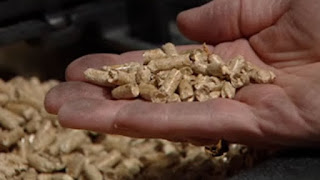
Not all wood pellets are carbon-neutral, says environmental advocate By Mitch Wiles, CBC News Posted: May 25, 2016 6:00 AM CT
 Concepts of Thinking: Geographic Perspective, Interrelationships,
Inquiry: Why are wood pellets being used instead of wood for burning? How can a carbon wood pellet be made carbon -neutral? Why might whole trees be used to create wood pellets?
Activity: Conduct an issue analysis and map out the stakeholders. How might spatial significance impact the type of wood pellet? Moving forward how should industries react to the findings that not all wood pellets are carbon-neutral? Communicate results via story map.
 Concepts of Thinking: Spatial Significance,
Patterns and Trends, Geographic Perspective, interrelationship
Concepts of Thinking: Spatial Significance,
Patterns and Trends, Geographic Perspective, interrelationship
Inquiry: Where might the best location be for these innovations? How might they contribute to the Canadian economy? How might these innovations impact the local environment?
Activity: Determine the criteria of each of the innovations to locate the possible places for these innovations. Create a spatial journal indicating the selected locations. Why patterns and trends develop? Compare the different types of innovations to determine the most likely to have the largest impact to Canada. Create a story map to communicate results.

Concepts of Thinking: Geographic Perspective, Interrelationships,
Inquiry: Why are wood pellets being used instead of wood for burning? How can a carbon wood pellet be made carbon -neutral? Why might whole trees be used to create wood pellets?
Activity: Conduct an issue analysis and map out the stakeholders. How might spatial significance impact the type of wood pellet? Moving forward how should industries react to the findings that not all wood pellets are carbon-neutral? Communicate results via story map.

Concepts of Thinking: Spatial Significance,
Patterns and Trends, Geographic Perspective, interrelationship
Inquiry: Where might the best location be for these innovations? How might they contribute to the Canadian economy? How might these innovations impact the local environment?
Activity: Determine the criteria of each of the innovations to locate the possible places for these innovations. Create a spatial journal indicating the selected locations. Why patterns and trends develop? Compare the different types of innovations to determine the most likely to have the largest impact to Canada. Create a story map to communicate results.
New study finds major earthquake threat from the Riasi fault in the Himalayas
 Concepts of Thinking: Geographic Perspective, Spatial Significance, Interrelationship
Inquiry: How might a major earthquake impact the Geographic Perspective of the area? How might people of the area prepare for the inevitable?
Activity: Create a spatial journal of earthquakes looking for patterns and trends to establish where vulnerable areas might be. Add population data to aid in the analysis. Create a story map to communicate results.

Concepts of Thinking: Geographic Perspective, Spatial Significance, Interrelationship
Inquiry: How might a major earthquake impact the Geographic Perspective of the area? How might people of the area prepare for the inevitable?
Activity: Create a spatial journal of earthquakes looking for patterns and trends to establish where vulnerable areas might be. Add population data to aid in the analysis. Create a story map to communicate results.
WORLD’S SMALLEST PORPOISE IS ON THE VERGE OF EXTINCTION
 Concepts of Thinking: Interrelationships, Patterns and Trends, Spatial Significance
Inquiry: How might gill fishing be stopped? How can the fishing of endangered species be allowed? How should governments and industries deal with this issue? What might some of the environmental issue be if this species becomes extinct?
Activity: Create a spatial journal of the issue by adding data of species range, human activity (fishing) and conduct an issues analysis to help determine a potential, doable, solution to the problem. Create a story map to communicate to an appropriate audience.
Climate change puts 1.3bn people and $158tn at risk, says World Bank
Larry Elliott Economics editor
 Concepts of Thinking: Geographic Perspective, Spatial Significance, Interrelationships
Inquiry: Even the most Capitalistic corporations will be worried about that much loss to their work force and their bottom line so why do some corporations still pretend Climate Change isn't a problem?
Activity: Create a spatial journal indicating where the most at risk areas are to Climate Change. Add to it population data for further analysis. How does Spatial Significance fit into problem? Can any Patterns and Trends be observed? Conduct an issue analysis and communicate strategies to deal with the issue via story map.
PERCEPTIONS
INDEX 2015 

Concepts of Thinking: Interrelationships, Patterns and Trends, Spatial Significance
Inquiry: How might gill fishing be stopped? How can the fishing of endangered species be allowed? How should governments and industries deal with this issue? What might some of the environmental issue be if this species becomes extinct?
Activity: Create a spatial journal of the issue by adding data of species range, human activity (fishing) and conduct an issues analysis to help determine a potential, doable, solution to the problem. Create a story map to communicate to an appropriate audience.
Climate change puts 1.3bn people and $158tn at risk, says World Bank
Larry Elliott Economics editor

Concepts of Thinking: Geographic Perspective, Spatial Significance, Interrelationships
Inquiry: Even the most Capitalistic corporations will be worried about that much loss to their work force and their bottom line so why do some corporations still pretend Climate Change isn't a problem?
Activity: Create a spatial journal indicating where the most at risk areas are to Climate Change. Add to it population data for further analysis. How does Spatial Significance fit into problem? Can any Patterns and Trends be observed? Conduct an issue analysis and communicate strategies to deal with the issue via story map.
PERCEPTIONS
INDEX 2015
 Concepts of Thinking: Patterns and Trends, Spatial Significance, Interrelationships, Geographic Perspective
Inquiry: How might Global Corruption impact people around the world? How can the people hurt the most from Global Corruption be helped? How might Global Corruption be dealt with to reduce its impact? Why might this Transparency International map not show the same patterns as the Panama Papers map? Why might two maps showing corruption in the world be different?
Activity: Create a thematic map of the high ranking countries and low ranking countries. Are any patterns evident? Why might this pattern appear? Conduct an issue analysis to develop a solution to the situation. How might the solution be introduced to the world? Create a story map to communicate the solution to the appropriate audience.

Concepts of Thinking: Patterns and Trends, Spatial Significance, Interrelationships, Geographic Perspective
Inquiry: How might Global Corruption impact people around the world? How can the people hurt the most from Global Corruption be helped? How might Global Corruption be dealt with to reduce its impact? Why might this Transparency International map not show the same patterns as the Panama Papers map? Why might two maps showing corruption in the world be different?
Activity: Create a thematic map of the high ranking countries and low ranking countries. Are any patterns evident? Why might this pattern appear? Conduct an issue analysis to develop a solution to the situation. How might the solution be introduced to the world? Create a story map to communicate the solution to the appropriate audience.
Air pollution levels rising in many of the world’s poorest cities World Health Organization
 Concepts of Thinking: Spatial Significance, Interrelationships, Patterns and Trends
Inquiry: What might be contributing to this trend? How will this trend impact the rest of the world?
Activity: Collect data on cities which are contributing the most air pollutants and create pie charts showing pollution per capita data spatial journal. Add to it population data and climate conditions to make predictions on future global impacts. Conduct an issue analysis to determine a potential solution to the pollution situation and communicate via story map.
CAPTIVE MARKET: UNDERSTANDING NUNAVUT’S COMPLEX AIRLINE INDUSTRY
 Concepts of Thinking: Spatial Significance, Patterns and Trends, Geographic Perspective
Inquiry: How might increased travel to the North and Iqaluit’s new international airport impact local ecosystems?
Activity: Create a spatial journal of the region containing human and environmental data. Conduct an issue analysis and make a judgement on what would be best for the region. Communicate results to an appropriate audience via story map.

Concepts of Thinking: Spatial Significance, Interrelationships, Patterns and Trends
Inquiry: What might be contributing to this trend? How will this trend impact the rest of the world?
Activity: Collect data on cities which are contributing the most air pollutants and create pie charts showing pollution per capita data spatial journal. Add to it population data and climate conditions to make predictions on future global impacts. Conduct an issue analysis to determine a potential solution to the pollution situation and communicate via story map.
CAPTIVE MARKET: UNDERSTANDING NUNAVUT’S COMPLEX AIRLINE INDUSTRY

Concepts of Thinking: Spatial Significance, Patterns and Trends, Geographic Perspective
Inquiry: How might increased travel to the North and Iqaluit’s new international airport impact local ecosystems?
Activity: Create a spatial journal of the region containing human and environmental data. Conduct an issue analysis and make a judgement on what would be best for the region. Communicate results to an appropriate audience via story map.
Lancaster Sound
An integral part of the Last Ice Area and an Arctic home for Inuit and wildlife
 Concepts of Thinking: Spatial Significance, Interrelationships, Patterns and Trends
Inquiry: How might Climate Change impact this region?

Concepts of Thinking: Spatial Significance, Interrelationships, Patterns and Trends
Inquiry: How might Climate Change impact this region?
Syria accused of airstrike on refugee camp as Assad pushes for 'final victory'
 Concepts of Thinking: Patterns and Trends, Interrelationships, Geographic Perspective
Inquiry: What might be the tipping point at which UN members vow to resolve the situation. Why have we not learned from Rwanda, etc?
Activity: Conduct an issue analysis and map the participants. Add to the map demographic data . Create a story map with outlining a possible solution and communicate to an appropriate audience.

Concepts of Thinking: Patterns and Trends, Interrelationships, Geographic Perspective
Inquiry: What might be the tipping point at which UN members vow to resolve the situation. Why have we not learned from Rwanda, etc?
Activity: Conduct an issue analysis and map the participants. Add to the map demographic data . Create a story map with outlining a possible solution and communicate to an appropriate audience.
Zimbabwe’s Wild Animals For Sale: National Parks Forced To Sell Wildlife Amid Drought BY MORGAN WINSOR, INTERNATIONAL BUSINESS TIMES
 CONCEPTS OF THINKING: SPATIAL SIGNIFICANCE, GEOGRAPHIC PERSPECTIVE, PATTERNS AND TRENDS
INQUIRY: WHAT MIGHT BE A BETTER ALTERNATIVE TO SELLING THE ANIMALS? HOW MIGHT SELLING OF THE ANIMALS IMPACT THEIR WELL BEING? WHEN MIGHT THE WEATHER CONDITION CHANGE TO SUPPORT THE ANIMALS?
ACTIVITY: CONDUCT AN ISSUE ANALYSIS TO HELP DETERMINE THE IMPACT OF SELLING THE ANIMALS AND MAP. ADD TO THE MAP THE LOCATION OF THE ANIMALS TO BE SOLD AS WELL AS WEATHER PATTERNS AND TRENDS TO HELP MAKE A PREDICTION AS TO WHEN CONDITION MIGHT GET BETTER.

CONCEPTS OF THINKING: SPATIAL SIGNIFICANCE, GEOGRAPHIC PERSPECTIVE, PATTERNS AND TRENDS
INQUIRY: WHAT MIGHT BE A BETTER ALTERNATIVE TO SELLING THE ANIMALS? HOW MIGHT SELLING OF THE ANIMALS IMPACT THEIR WELL BEING? WHEN MIGHT THE WEATHER CONDITION CHANGE TO SUPPORT THE ANIMALS?
ACTIVITY: CONDUCT AN ISSUE ANALYSIS TO HELP DETERMINE THE IMPACT OF SELLING THE ANIMALS AND MAP. ADD TO THE MAP THE LOCATION OF THE ANIMALS TO BE SOLD AS WELL AS WEATHER PATTERNS AND TRENDS TO HELP MAKE A PREDICTION AS TO WHEN CONDITION MIGHT GET BETTER.
Peak Oil Could Hit In Just 14 Years, But It Might Not Be What You Think
The Huffington Post Canada | By Jesse Ferreras
 Concepts of Thinking: Patterns and Trends, Geographic Perspective, interrelationships, Spatial Significance
Inquiry: How might peak oil be calculated? What might the impacts be of reaching Peak Oil?
Activity: Conduct an issue analysis. Analyze maps, graphs and charts to make predictions on the effects of reaching Peak Oil. Create a story map to communicate results to an appropriate audience.

Concepts of Thinking: Patterns and Trends, Geographic Perspective, interrelationships, Spatial Significance
Inquiry: How might peak oil be calculated? What might the impacts be of reaching Peak Oil?
Activity: Conduct an issue analysis. Analyze maps, graphs and charts to make predictions on the effects of reaching Peak Oil. Create a story map to communicate results to an appropriate audience.
In Photos: The Largest Burning of Ivory in History By Frederick Paxton and Ben Bryant
 Concepts of Thinking: Patterns and Trends, Interrelationship, Spatial Significance, Geographic Perspective
Inquiry: If ivory is so expensive why might people be burning so much of it? What might be the impact of burning this ivory be?
Activity: Create a proportional width arrow map of where the ivory is coming from and where it is going. Conduct an issue analysis to help understand the stakeholders. Make prediction as to what might happen and create recommendations as to what should be happening that can be used to communicate to a particular audience.

Concepts of Thinking: Patterns and Trends, Interrelationship, Spatial Significance, Geographic Perspective
Inquiry: If ivory is so expensive why might people be burning so much of it? What might be the impact of burning this ivory be?
Activity: Create a proportional width arrow map of where the ivory is coming from and where it is going. Conduct an issue analysis to help understand the stakeholders. Make prediction as to what might happen and create recommendations as to what should be happening that can be used to communicate to a particular audience.
El Niño and the stratospheric polar vortex
Author: Amy Butler
 Concepts of Thinking: Spatial Significance, Patterns and Trends, Interrelationship
Inquiry: How might the vortex impact El Nino? How might human activities contribute to these environmental events
Activity: Create a map of the areas affected by each of these environmental events, human activities/development in the area. Use graphs and charts to make predictions of future events and map out results that can then be communicated to the appropriate audience via story map.

Concepts of Thinking: Spatial Significance, Patterns and Trends, Interrelationship
Inquiry: How might the vortex impact El Nino? How might human activities contribute to these environmental events
Activity: Create a map of the areas affected by each of these environmental events, human activities/development in the area. Use graphs and charts to make predictions of future events and map out results that can then be communicated to the appropriate audience via story map.
California plans to unleash fly to crush ivy invasion By

 Concepts of Thinking: Spatial Significance, Interrelationships, Patterns and Trends
Inquiry: How might be a plausible
Activity: Conduct an issue analysis and map out the data as well as the extent of the bleaching along the Reef. Add to the map human data i.e. distribution, industry etc. Create a story map to communicate your results
 Concepts of Thinking: Spatial Significance, Interrelationships, Patterns and Trends
Inquiry: How might be a plausible
way of reducing the human impact?
Activity: Conduct an issue analysis and map out the data as well as the extent of the bleaching along the Reef. Add to the map human data i.e. distribution, industry etc. Create a story map to communicate your results
Canadian waters getting safer, but research gaps limit full understanding of shipping risks
 Concepts of Thinking: Spatial Significance, Geographic Perspective, Patterns and Trends, Interrelationship
Inquiry: What might be needed to better understand the shipping risk?
Activity: Conduct an issue analysis. Create a map of the stakeholders to help develop a solution. Create a story map showing a possible solutions to reduce shipping risks in Canadian waters.

Concepts of Thinking: Spatial Significance, Geographic Perspective, Patterns and Trends, Interrelationship
Inquiry: What might be needed to better understand the shipping risk?
Activity: Conduct an issue analysis. Create a map of the stakeholders to help develop a solution. Create a story map showing a possible solutions to reduce shipping risks in Canadian waters.
Do fracking activities cause earthquakes? Seismologists and the state of Oklahoma say yes By Terry Reith and Briar Stewart, CBC News
 Concepts of Thinking: Spatial Significance, Patterns and Trends, Geographic Perspective
Inquiry: How could Fracking contribute to earthquakes
Activity: Create a map of where fracking is taking place. Add to it data about where earthquake epicentres are located as well as population information. Observe any patterns that may have appeared. Gather other information on fracking. Decide weather fracking can contribute to earthquakes or not. Create a story map to communicate to an appropriate audience a solution to the situation.

Concepts of Thinking: Spatial Significance, Patterns and Trends, Geographic Perspective
Inquiry: How could Fracking contribute to earthquakes
Activity: Create a map of where fracking is taking place. Add to it data about where earthquake epicentres are located as well as population information. Observe any patterns that may have appeared. Gather other information on fracking. Decide weather fracking can contribute to earthquakes or not. Create a story map to communicate to an appropriate audience a solution to the situation.
Arctic Cruises Are Extinction Tourism By Another Name Capt. Trevor Greene
 Concepts of Thinking: Geographic Perspective, Spatial Significance, Patterns and Trends, Interrelationship
Inquiry: How might tourist enjoy the Arctic without destroying it? What have been solutions in other similar situations? Could these solutions work for the the Arctic?
Activity: Map out the areas of greatest impact. Conduct an issue analysis and add to map the stakeholders. Determine a best fit solution and communicate to an appropriate audience via story map.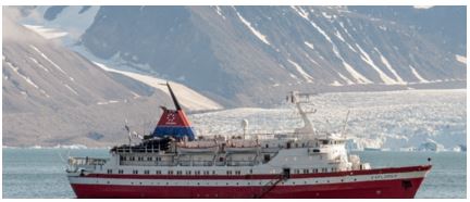
Brazil swine flu: H1N1 vaccinations to begin as virus kills 230 BBC
 Concepts of Thinking: Interrelationship, Patterns and Trends, Spatial Significance,
Inquiry: Where did this virus originate from?How might this virus be prevented, stopped from spreading? Where might this virus move to?
Activity: Create a map of the areas that are affected, past and present. Determine the spatial significance that contribute to the movement of the virus. Make predictions as to where the virus could move to. How might geographic perspective contribute to how the virus could be dealt with. Communicate result to an appropriate audience via story map.

Concepts of Thinking: Interrelationship, Patterns and Trends, Spatial Significance,
Inquiry: Where did this virus originate from?How might this virus be prevented, stopped from spreading? Where might this virus move to?
Activity: Create a map of the areas that are affected, past and present. Determine the spatial significance that contribute to the movement of the virus. Make predictions as to where the virus could move to. How might geographic perspective contribute to how the virus could be dealt with. Communicate result to an appropriate audience via story map.
Brazil Amazon dam project suspended over concerns for indigenous people
Bruce Douglas in Rio de Janeiro
 Concepts of Thinking: Geographic Perspective, Spatial Significance, Patterns and Trends, Interrelationships
Inquiry: How might the Brasil now meet their energy needs? How might other countries show they listen to the concerns of their indigenous people?
Activity: Create an energy map of Brasil, generation and distribution. Conduct an issue analysis. Determine an alternative energy source and communicate to an appropriate audience.

Concepts of Thinking: Geographic Perspective, Spatial Significance, Patterns and Trends, Interrelationships
Inquiry: How might the Brasil now meet their energy needs? How might other countries show they listen to the concerns of their indigenous people?
Activity: Create an energy map of Brasil, generation and distribution. Conduct an issue analysis. Determine an alternative energy source and communicate to an appropriate audience.
Hunger Map 2015 World Food Programme
 Concepts of Thinking: Spatial Significance, Patterns and Trends, Geographic Perspective
Inquiry: In a world that is able to produce a surplus of food why are people still allowed to go hungry? How might a countries hunger rating change if only looking at domestic data (Canada as an example)?
Activity: Determine the stakeholder and conduct an issue analysis. Create flow map of the distribution of food. Add to the the flow of resource and aid countries around the world are involved in. Other data. Do any patterns appear? What might be some conclusions that can be made about food scarcity and Geographic Perspective and or Spatial significance? Communicate results to an appropriate audience via story map.

Concepts of Thinking: Spatial Significance, Patterns and Trends, Geographic Perspective
Inquiry: In a world that is able to produce a surplus of food why are people still allowed to go hungry? How might a countries hunger rating change if only looking at domestic data (Canada as an example)?
Activity: Determine the stakeholder and conduct an issue analysis. Create flow map of the distribution of food. Add to the the flow of resource and aid countries around the world are involved in. Other data. Do any patterns appear? What might be some conclusions that can be made about food scarcity and Geographic Perspective and or Spatial significance? Communicate results to an appropriate audience via story map.
30 years after Chernobyl, UGA camera study reveals wildlife abundance in CEZ
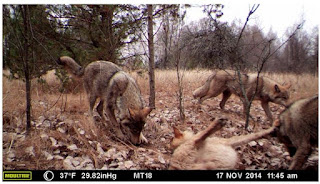
 Concepts of Thinking: Spatial Significance, Interrelationships, Patterns and Trends
Inquiry: How have these animals been able to survive with the increased levels of radiation in their habitat? How likely is I that humans will be able to thrive with the increased radiation rates?
Activity: Map the Chernobyl nuclear power plant location. Determine level of contamination by creating buffers to show the range of contamination. Add population data and other relevant data to make predictions for how long before the land might be safe for people to go back to a "regular" routine in the area.
 Concepts of Thinking: Spatial Significance, Patterns and Trends, Geographic Perspective
Inquiry: What might some of the consequences be to these increase levels? Where might these impacts be felt the most?
Activity: Create a map of the regions of the world that have diesel cars on the road. Add to the map air quality data and human patterns. Make some predictions of environmental impacts. Communicate to an appropriate audience via story map.
Receding ice causing longer swims for polar bears

Concepts of Thinking: Spatial Significance, Interrelationships, Patterns and Trends
Inquiry: How have these animals been able to survive with the increased levels of radiation in their habitat? How likely is I that humans will be able to thrive with the increased radiation rates?
Activity: Map the Chernobyl nuclear power plant location. Determine level of contamination by creating buffers to show the range of contamination. Add population data and other relevant data to make predictions for how long before the land might be safe for people to go back to a "regular" routine in the area.
 Concepts of Thinking: Spatial Significance, Patterns and Trends, Geographic Perspective
Inquiry: What might some of the consequences be to these increase levels? Where might these impacts be felt the most?
Activity: Create a map of the regions of the world that have diesel cars on the road. Add to the map air quality data and human patterns. Make some predictions of environmental impacts. Communicate to an appropriate audience via story map.
Receding ice causing longer swims for polar bears
 Concepts of Thinking: Spatial Significance, Patterns and Trends, interrelationships
Inquiry: How might the increased swim distance impact the polar bears sustainability?
Activity: Create a map of the past and current range of Arctic Ice, polar bear bear range and any other potential contributing factor. Make predictions as to how far the polar bears may have to swim in the future and determine the impact. Communicate to an appropriate audience possible solutions to this problem via story map.
 Concepts of Thinking: Geographic Perspective, Interrelationships
Inquiry: How might calling the ISIS atrocities a Genocide change how governments of the world treat the situation? How might Canada's government view this issue?
Activity: Create a map of the areas that are under ISIS control. Conduct an issue analysis to determine what might the best solution be to deal with ISIS. Use a story map to communicate your results to an appropriate audience.
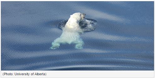
Concepts of Thinking: Spatial Significance, Patterns and Trends, interrelationships
Inquiry: How might the increased swim distance impact the polar bears sustainability?
Activity: Create a map of the past and current range of Arctic Ice, polar bear bear range and any other potential contributing factor. Make predictions as to how far the polar bears may have to swim in the future and determine the impact. Communicate to an appropriate audience possible solutions to this problem via story map.

Concepts of Thinking: Geographic Perspective, Interrelationships
Inquiry: How might calling the ISIS atrocities a Genocide change how governments of the world treat the situation? How might Canada's government view this issue?
Activity: Create a map of the areas that are under ISIS control. Conduct an issue analysis to determine what might the best solution be to deal with ISIS. Use a story map to communicate your results to an appropriate audience.
How Geography Impacts Flu Outbreaks by

Concepts of Thinking: Spatial Significance, Interrelationships, Patterns and Trends
Inquiry: How might Doctors be able to use Geography to manage flu or other illnesses?
Activity: Create a map of resent disease (zika virus) outbreaks to help identify patterns and trends. What might be the spatial significance of these areas? Make predictions on where the virus may move to. Communicate results to an appropriate audience via story map.
Photos From Ecuador Show Devastation After The Deadly Earthquake
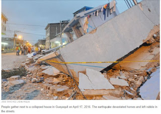 Concepts of Thinking: Spatial Significance, Geographic Perspective, Interrelationships
Inquiry: How might people best help the people who need help? Where might people go to get the aid they need?
Activity: Create a map of the area and the plate boundaries, fault lines and human patterns. Conduct an issue analysis to help determine what could be done. Communicate via story map to the appropriate audience.

Concepts of Thinking: Spatial Significance, Geographic Perspective, Interrelationships
Inquiry: How might people best help the people who need help? Where might people go to get the aid they need?
Activity: Create a map of the area and the plate boundaries, fault lines and human patterns. Conduct an issue analysis to help determine what could be done. Communicate via story map to the appropriate audience.
Governor wants to change, but not scrap, North Carolina law
By
Severe drought leaves millions relying on emergency aid
 Concepts of Thinking: Spatial Significance, Interrelationship, Patterns and Trends
Inquiry: What might be the spatial significance of this region that contribute to the drought?
Activity: Gather data on droughts of the region and create a map to help observe patterns and trends. Conduct an issue analysis and add stake holders to the map. Create a story map to communicate results.

Concepts of Thinking: Spatial Significance, Interrelationship, Patterns and Trends
Inquiry: What might be the spatial significance of this region that contribute to the drought?
Activity: Gather data on droughts of the region and create a map to help observe patterns and trends. Conduct an issue analysis and add stake holders to the map. Create a story map to communicate results.
Boko Haram targets geography teachers By Colin Freeman

Concepts of Thinking:
Geographic Perspective,
Inquiry: What might some people want to silence another group people?
Activity: Conduct an issue analysis of the situation. Add this information to a map and observe any patterns or trends that may appear. Make predictions on other areas that might go through a similar situation. Try to develop a solution to this situation and communicate to an appropriate audience via story map.
Attawapiskat declares state of emergency over spate of suicide attempts By Kate Rutherford, CBC News
 Concepts of Thinking: Interrelationships, Patterns and Trends, Spatial Significance, Geographic Perspective
Inquiry: What might the factors be that are contributing to this community having an enormous suicide rate? What other communities might be facing a similar situation? How might this trend be turned around?
Activity: Create a map to determine the spatial significance of the area. Complete an issue analysis of the problem and and the stakeholders to the map. Communicate potential solution to the appropriate audience via story map.

Concepts of Thinking: Interrelationships, Patterns and Trends, Spatial Significance, Geographic Perspective
Inquiry: What might the factors be that are contributing to this community having an enormous suicide rate? What other communities might be facing a similar situation? How might this trend be turned around?
Activity: Create a map to determine the spatial significance of the area. Complete an issue analysis of the problem and and the stakeholders to the map. Communicate potential solution to the appropriate audience via story map.
 Concepts of Thinking: Interrelationship, Patterns and Trends
Inquiry: Why has the Tiger population been able to increase in size over time? How might what happened to the Tigers numbers happen to other species?
Activity: Create a map of the range of the tigers, forested areas, human areas, and other data that is available. Conduct an issue analysis of the issue. If current trends continue how might the landscape look? Make predictions on the tigers plight.

Concepts of Thinking: Interrelationship, Patterns and Trends
Inquiry: Why has the Tiger population been able to increase in size over time? How might what happened to the Tigers numbers happen to other species?
Activity: Create a map of the range of the tigers, forested areas, human areas, and other data that is available. Conduct an issue analysis of the issue. If current trends continue how might the landscape look? Make predictions on the tigers plight.
Maritime boat building 'boom' fuelled by lobster industry
By Paul Withers, CBC News
 Concepts of Thinking: Spatial Significance,
Geographic Perspective, Interrelationships
Concepts of Thinking: Spatial Significance,
Geographic Perspective, Interrelationships
Inquiry: Why has there been such an "boom" in building lobster boats? What might be the impacts of increased production of lobster boats?
Activity: Gather information and data on lobster "fishing". Conduct an issue analysis. Create a map of the extent of lobster fishing. Evaluate the human ans environmental impacts of increased lobster fishing to determine proper management of the resource. Communicate results to an appropriate audience via story map.
By Paul Withers, CBC News

Concepts of Thinking: Spatial Significance,
Geographic Perspective, Interrelationships
Inquiry: Why has there been such an "boom" in building lobster boats? What might be the impacts of increased production of lobster boats?
Activity: Gather information and data on lobster "fishing". Conduct an issue analysis. Create a map of the extent of lobster fishing. Evaluate the human ans environmental impacts of increased lobster fishing to determine proper management of the resource. Communicate results to an appropriate audience via story map.
Massive deforestation found in Brazil’s Cerrado

Concepts of Thinking: Interrelationships, Patterns and Trends, Spatial Significance, Geographic Perspective
Inquiry: How might agriculture in the rain forest be sustainable?
Activity: Create a map showing the extent of rain forest deforestation over time. Conduct an issue analysis and add these groups to the map. Create a story map to communicate a solution to the problem.
Mekong megadrought erodes food security
 Concepts of Thinking: Spatial Significance, Interrelationships, Patterns and Trends
Inquiry: What might be the cause of the drought? Who might be most affected by the drought? What activities might be introduced to prevent such droughts happening in the future?
Activity: Create a spatial journal of the area /river basin indicating the different human activities. Show the extent/range of people who rely on the river basin for food. Identify locations where people may have to go to collect food in the future due to the drought. Communicate possible solutions to help alleviate the situation via story map.

Concepts of Thinking: Spatial Significance, Interrelationships, Patterns and Trends
Inquiry: What might be the cause of the drought? Who might be most affected by the drought? What activities might be introduced to prevent such droughts happening in the future?
Activity: Create a spatial journal of the area /river basin indicating the different human activities. Show the extent/range of people who rely on the river basin for food. Identify locations where people may have to go to collect food in the future due to the drought. Communicate possible solutions to help alleviate the situation via story map.
Canada’s oilpatch suffers biggest drop in investment in almost 70 years, CAPP warns Yadullah Hussain | April 7, 2016 9:42 AM ET
 Concepts of Thinking: Patterns and Trends, Spatial Significance, Geographic Perspective, interrelationships
Inquiry: Why might Canada's Oil patch continue to suffer?
Activity: Conduct an issue analysis and map out the stakeholders. Make predictions on the future of Canada's oil industry and Canada's economy.

Concepts of Thinking: Patterns and Trends, Spatial Significance, Geographic Perspective, interrelationships
Inquiry: Why might Canada's Oil patch continue to suffer?
Activity: Conduct an issue analysis and map out the stakeholders. Make predictions on the future of Canada's oil industry and Canada's economy.
Ontario rescinds controversial proposals to ease wolf and coyote hunting regs in north
By Gord Ellis, CBC News
 Concepts of Thinking: Geographic Perspective, Patterns and Trends, Spatial Significance
Inquiry: How might the hunting of such animals impact human and natural systems.
Activity: Create an issue analysis of of the stakeholders. Create a map of the range of the wolf and coyote populations. Add layers such as cities, different animals, and vegetation etc. Determine what should happen next. Communicate results via a story map.

Concepts of Thinking: Geographic Perspective, Patterns and Trends, Spatial Significance
Inquiry: How might the hunting of such animals impact human and natural systems.
Activity: Create an issue analysis of of the stakeholders. Create a map of the range of the wolf and coyote populations. Add layers such as cities, different animals, and vegetation etc. Determine what should happen next. Communicate results via a story map.
Candidates compete to become U.N. secretary-general By
 Concepts of Thinking: Geographic Perspective, Interrelationships
Inquiry: How is the UN secretary-general selected? Why might this role need to change?
Activity: Conduct an issue analysis of the candidates. Create a spatial journal of where the past and present secretary-general and current candidates country of origin. Analyse results for patterns and trends. Make predictions as to who the next secretary-general may be, take in to consideration current world events. Communicate results to an appropriate audience via story map.

Concepts of Thinking: Geographic Perspective, Interrelationships
Inquiry: How is the UN secretary-general selected? Why might this role need to change?
Activity: Conduct an issue analysis of the candidates. Create a spatial journal of where the past and present secretary-general and current candidates country of origin. Analyse results for patterns and trends. Make predictions as to who the next secretary-general may be, take in to consideration current world events. Communicate results to an appropriate audience via story map.
WHAT’S GOING ON IN NAGORNO-KARABAKH? NATIONAL GEOGRAPHIC EDUCATION
 Concepts of Thinking: Spatial Significance. Geographic Perspective, Patterns and Ternds
Inquiry: Why might this conflict going on? Why has this conflict not been widely publicized?
Activity: Complete an issue analysis of the issue. Map out the results to determine any patterns or trends. Communicate your results to an appropriate audience to create change to this situation.

Concepts of Thinking: Spatial Significance. Geographic Perspective, Patterns and Ternds
Inquiry: Why might this conflict going on? Why has this conflict not been widely publicized?
Activity: Complete an issue analysis of the issue. Map out the results to determine any patterns or trends. Communicate your results to an appropriate audience to create change to this situation.
The Panama Papers: how the world’s rich and famous hide their money offshore Juliette Garside, Holly Wattand David Pegg
 Concepts of Thinking: Geographic Perspective, Spatial Significance, Patterns and Trends, Interrelationships

Inquiry: Why not allow equal access to such tax avoidance opportunities? How might such tax avoidance impact the local or national health of a country?
Activity: Create a proportional width arrow map to show where the taxes are leaving and where it is going to as well as the amount. Gather data on GDP, Life Expectancy, and Literacy to help determine how this tax evasion is impacting different parts of the world. Communicate your findings to an appropriate audience to help increase access to things like clean and safe drinking water.
Activity: Create a proportional width arrow map to show where the taxes are leaving and where it is going to as well as the amount. Gather data on GDP, Life Expectancy, and Literacy to help determine how this tax evasion is impacting different parts of the world. Communicate your findings to an appropriate audience to help increase access to things like clean and safe drinking water.
It's Expensive To Be Poor 
 Concepts of Thinking: Geographic Perspective, Spatial Significance, Patterns and Trends
Inquiry: Who owns the water? How is it possible that a culture would make the poorest people pay the most for water? What could the wealthy people, corporations, and governments do to increase fair access to clean water for everyone?
Activity: Complete an issue analysis to determine the different values and beliefs associated with the issue.Map out areas (local, regional, or global) of areas where access to clean/safe drinking water is not readily available. Observe patterns that may appear. What could be done to alleviate the situation for people in need of clean/safe drinking water. Communicate to an appropriate audience.

Concepts of Thinking: Geographic Perspective, Spatial Significance, Patterns and Trends
Inquiry: Who owns the water? How is it possible that a culture would make the poorest people pay the most for water? What could the wealthy people, corporations, and governments do to increase fair access to clean water for everyone?
Activity: Complete an issue analysis to determine the different values and beliefs associated with the issue.Map out areas (local, regional, or global) of areas where access to clean/safe drinking water is not readily available. Observe patterns that may appear. What could be done to alleviate the situation for people in need of clean/safe drinking water. Communicate to an appropriate audience.
Migrant workers suffer 'appalling treatment' in Qatar World Cup stadiums, says Amnesty
 Concepts of Thinking: Geographic Perspective, Interrelationships, Patterns and Trends
Inquiry: Why are there so many migrant workers working in Qatar? What laws might there be for these migrant workers? How else might migrant workers be protected? Where else might workers be treated this poorly? Who should be responsible for ensure workers safety?
Activity: Collect data on where the migrant workers are coming form to help determine spatial significance by mapping out the data. Use proportional symbols to help better display the data for analysis. Complete an issue analysis to better understand the different views and communicate to an appropriate audience a plan of action to help resolve the situation. i.e. story map.

Concepts of Thinking: Geographic Perspective, Interrelationships, Patterns and Trends
Inquiry: Why are there so many migrant workers working in Qatar? What laws might there be for these migrant workers? How else might migrant workers be protected? Where else might workers be treated this poorly? Who should be responsible for ensure workers safety?
Activity: Collect data on where the migrant workers are coming form to help determine spatial significance by mapping out the data. Use proportional symbols to help better display the data for analysis. Complete an issue analysis to better understand the different views and communicate to an appropriate audience a plan of action to help resolve the situation. i.e. story map.
Donald Trump retracts call for women who have abortions to be 'punished'
 Jessica Glenza; the Gaudrian

Concepts of Thinking: Interrelationships, Geographic Perspective
Inquiry: How might Trumps policy impact womens' rights in the US and in Canada? How might Canada's relationship with the US be affected if Trumps views are adopted by the majority of US citizens?
Activity: Complete an issue analysis of the stakeholders, Trump, US citizens, Canadian governments', and Canadian citizens involved in this situation and map them to determine how spatial significance may impact views of the stakeholders. Communicate to the appropriate audience what Canada might do if Trump were to become President of the USA.
Sea levels set to 'rise far more rapidly than expected Damian Carrington
 Antarctica’s snowfall was expected to keep the ice sheet in balance but it is less stable than previously thought. Photograph: Steve Mandel / Barcroft Media
Concepts of Thinking: Spatial Significance, Patterns and Trends
Inquiry: How might the expertise make these predictions? How should carbon emissions be decreased?
Activity: Collect and map carbon emissions data to determine where the majority of carbon is coming from. How might spatial significance impact carbon emissions? How can geographic perspective help influence carbon producers?
Concepts of Thinking: Interrelationships, Geographic Perspective
Inquiry: How might Trumps policy impact womens' rights in the US and in Canada? How might Canada's relationship with the US be affected if Trumps views are adopted by the majority of US citizens?
Activity: Complete an issue analysis of the stakeholders, Trump, US citizens, Canadian governments', and Canadian citizens involved in this situation and map them to determine how spatial significance may impact views of the stakeholders. Communicate to the appropriate audience what Canada might do if Trump were to become President of the USA.
Sea levels set to 'rise far more rapidly than expected Damian Carrington

Antarctica’s snowfall was expected to keep the ice sheet in balance but it is less stable than previously thought. Photograph: Steve Mandel / Barcroft Media
Concepts of Thinking: Spatial Significance, Patterns and Trends
Inquiry: How might the expertise make these predictions? How should carbon emissions be decreased?
Activity: Collect and map carbon emissions data to determine where the majority of carbon is coming from. How might spatial significance impact carbon emissions? How can geographic perspective help influence carbon producers?
Shoal Lake 40 First Nation Advocates Say More Money Needed For All-Weather Road By The Canadian Press
 Concepts of Thinking: Spatial Significance, Patterns and Trends, Interrelationships, Geographic Perspective
Inquiry: How could a community in Canada be under a boil water alert for so long? How could an all weather road help this community? Might there be other communities in similar situations?
Activity: Create a map showing the spatial significance of Shoal Lake 40.Gather information on other communities under a boil water advisory. Can any patterns be observed? What spatial significance is observed? How can this issue be addressed? Communicate results to and appropriate audience via story map.

Concepts of Thinking: Spatial Significance, Patterns and Trends, Interrelationships, Geographic Perspective
Inquiry: How could a community in Canada be under a boil water alert for so long? How could an all weather road help this community? Might there be other communities in similar situations?
Activity: Create a map showing the spatial significance of Shoal Lake 40.Gather information on other communities under a boil water advisory. Can any patterns be observed? What spatial significance is observed? How can this issue be addressed? Communicate results to and appropriate audience via story map.
Immigrants Beat Canadians At Starting Businesses: StatsCan
The Huffington Post Canada | By Jesse Ferreras
 Concepts of Thinking: Geographic Perspective, Patterns and Trends
Inquiry: Why are immigrants beating Canadians at starting businesses? How might this pattern impact the Canadian Economy?
The Huffington Post Canada | By Jesse Ferreras

Concepts of Thinking: Geographic Perspective, Patterns and Trends
Inquiry: Why are immigrants beating Canadians at starting businesses? How might this pattern impact the Canadian Economy?
‘Burnt Hot Dog’ sea cucumbers raise red flags for threatened global fisheries
 Concepts of Thinking: Spatial Significance, Interrelationships
Inquiry: How does Spatial Significance contribute to the health of the Burnt Hot Dog? What might be done to maintain a healthy Burnt Hot Dog population?
Activity: Create a map Burnt Hot Dog populations around the world. Distinguish between healthy and none healthy populations. Observe any patterns that may appear. How might spacial significance impact the health of the Burnt Hot Dog?

Concepts of Thinking: Spatial Significance, Interrelationships
Inquiry: How does Spatial Significance contribute to the health of the Burnt Hot Dog? What might be done to maintain a healthy Burnt Hot Dog population?
Activity: Create a map Burnt Hot Dog populations around the world. Distinguish between healthy and none healthy populations. Observe any patterns that may appear. How might spacial significance impact the health of the Burnt Hot Dog?
Obama lands in Cuba as first US president to visit in nearly a century
Dan Roberts in Havana
 Concepts of Thinking: Geographic Perspective,
Interrelationships, Spatial Significance
Concepts of Thinking: Geographic Perspective,
Interrelationships, Spatial Significance
Inquiry: Why has it been so long between US presidential visits? Why might the US be interested in relations with Cuba?
Activity: Investigate reasons why Cuba might be getting more attention i.e. economic, political, social activities. Locate stakeholders associated with Cuba to determine significance. How might this visit impact Canada?
Dan Roberts in Havana

Concepts of Thinking: Geographic Perspective,
Interrelationships, Spatial Significance
Inquiry: Why has it been so long between US presidential visits? Why might the US be interested in relations with Cuba?
Activity: Investigate reasons why Cuba might be getting more attention i.e. economic, political, social activities. Locate stakeholders associated with Cuba to determine significance. How might this visit impact Canada?
More pain for Canada’s natural gas producers: U.S. drillers ready to pounce and reverse flow northward
Concepts of Thinking: Spatial Significance, Geographic Perspective, Patterns and Trends
Inquiry: Why might Canada be importing it's oil?

Concepts of Thinking: Spatial Significance, Geographic Perspective, Patterns and Trends
Inquiry: Why might Canada be importing it's oil?
Mineral exploration spending expected to plummet this year in Nunavut, Yukon

Concepts of Thinking: Geographic Perspective, Patterns and Trends, Interrelationships, Spatial Significance
Inquiry: How might the reduction in spending impact different parts of the North?
Activity: Answer the inquiry question by: Determine the interrelationships of mining and the community/ the environment by mapping the mines locations and other human activities as well as environmental features (Lakes, rivers, wetlands, etc). Communicate to the appropriate audience solutions to this situation.
February continues streak of record low Arctic sea ice extent
By Natasha Vizcarra, National Snow and Ice Data Center

Concepts of Thinking: Spatial Significance, Interrelationships, Patterns and Trends
Inquiry: How might this pattern of low Arctic Sea ice impact the different interrelationships?
Activity: Create a map to outline the extent of the Arctic sea ice, add other data such as human activity, climate conditions etc. to answer the inquiry questions.
Polar bears migrate north as rising temperatures hasten Arctic ice melt Darryl Fears for the Washington Post
 Concepts of Thinking: Spatial Significance, Interrelationships, Patterns and Trends
Inquiry: How might the migration patterns of the Polar Bears changed? What might be the consequence of such change?
Activity: Create a map to outline migration patterns of Polar bears add other data such as human activity, climate conditions etc. to answer the inquiry questions.
True North refugees: Where 25,000 Syrians have settled in Canada
 Concepts of Thinking: Spatial Significance, Patterns and Trends
Inquiry: How might the ideal location for an Syrian refugee family be determined?
Activity: Have a class discussion on the characteristics that should be met to help support Syrian refugee families. Gather Canadian demographic data to map out potential locations. Evaluate the spatial significance of potential locations to determine where new Syrian refugees needs could be best served.

Concepts of Thinking: Spatial Significance, Patterns and Trends
Inquiry: How might the ideal location for an Syrian refugee family be determined?
Activity: Have a class discussion on the characteristics that should be met to help support Syrian refugee families. Gather Canadian demographic data to map out potential locations. Evaluate the spatial significance of potential locations to determine where new Syrian refugees needs could be best served.
How access to water changed the lives of these 4 women
This article was written by Morée Scofield, photos contributed by Benjamin Heath and under copyright in support of Water.org.
 Concepts of Thinking: Patterns and Trends, Interrelationships,
Inquiry: Why isn't water accessibility equitable? How might global access to safe water for all be accomplished?
Activity: Determine the spatial significance that contribute to reduced access to safe water via a spatial journal. Evaluate the different stakeholders views of the issue and devise a plan of action to improve water access.
This article was written by Morée Scofield, photos contributed by Benjamin Heath and under copyright in support of Water.org.
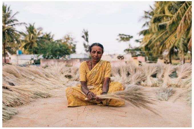
Concepts of Thinking: Patterns and Trends, Interrelationships,
Inquiry: Why isn't water accessibility equitable? How might global access to safe water for all be accomplished?
Activity: Determine the spatial significance that contribute to reduced access to safe water via a spatial journal. Evaluate the different stakeholders views of the issue and devise a plan of action to improve water access.
Refugee crisis: European leaders demand urgent support for Greece
Jon Henley in London,Jennifer Rankin in Brussels,Helena Smith in Thessaloniki, and Peter Walker in Calais
Jon Henley in London,Jennifer Rankin in Brussels,Helena Smith in Thessaloniki, and Peter Walker in Calais
 Concepts of Thinking: Interrelationships, Geographic Perspective, Spatial Significance, Patterns and Trends
Inquiry: How should this crisis be dealt with so it will end for millions of people. Why is not just a Syrian issue?
Activity: Complete an issue analysis of the issue. Create a spatial journal of the stakeholders with demographic data. Devise a potential solutions and communicate via story map for an appropriate audience.

Concepts of Thinking: Interrelationships, Geographic Perspective, Spatial Significance, Patterns and Trends
Inquiry: How should this crisis be dealt with so it will end for millions of people. Why is not just a Syrian issue?
Activity: Complete an issue analysis of the issue. Create a spatial journal of the stakeholders with demographic data. Devise a potential solutions and communicate via story map for an appropriate audience.
Stunning Photos Of Norway's Reindeer Hide A Radioactive Secret
 Concepts of Thinking: Interrelationships, Patterns and Trends, Spatial Significance, Geographic Perspective
Inquiry: How could radio active fallout still be impacting people and animals 30 years after a nuclear melt down that was more than 1600 km away? What might be some of the reasonable precautions people could take to reduce the impacts of radio active contamination?
Activity: Create a story map indicating the spatial significance of the disaster and the areas that have been contaminated. Document the results of this contamination, evaluate patterns and trends of the contamination, determine the interrelationship to show cause and effect of the contamination, take into consideration geographic perspective. Communicate suggestions/course of action that could be in place for when/if the next melt down occurs.

Concepts of Thinking: Interrelationships, Patterns and Trends, Spatial Significance, Geographic Perspective
Inquiry: How could radio active fallout still be impacting people and animals 30 years after a nuclear melt down that was more than 1600 km away? What might be some of the reasonable precautions people could take to reduce the impacts of radio active contamination?
Activity: Create a story map indicating the spatial significance of the disaster and the areas that have been contaminated. Document the results of this contamination, evaluate patterns and trends of the contamination, determine the interrelationship to show cause and effect of the contamination, take into consideration geographic perspective. Communicate suggestions/course of action that could be in place for when/if the next melt down occurs.
CNN Reporting From Cape Breton As Trump-Inspired Spotlight Continues
CP | By The Canadian Press
 Concepts of Thinking: Spatial Significance, Interrelationships, Geographic Perspective
Inquiry: Why might some Americans be looking at moving North if Donald Trump is elected as President?
Activity: complete an issue analysis of this event. Determine the best course of action and communicate via story map to the appropriate audience.
CP | By The Canadian Press

Concepts of Thinking: Spatial Significance, Interrelationships, Geographic Perspective
Inquiry: Why might some Americans be looking at moving North if Donald Trump is elected as President?
Activity: complete an issue analysis of this event. Determine the best course of action and communicate via story map to the appropriate audience.
Canada GDP Grew 0.8 Per Cent In Fourth Quarter Of 2015
 Concepts of Thinking: Patterns and Trends, Geographic Perspective, Spatial Significance
Inquiry: How might this growth impact Canadians across the country?
Activity: Collect data on the growth and decline of Canadian economy. Create graphs and charts to represent the patterns and trends of the economy. Determine what impact spatial significance plays in the Canadian economy by mapping certain events/industries that are improving/declining. What are some observations can be made? What predictions can be made? Could this be a go time to buy a house and where might the best place to buy be?
March 3rd - Climate Change & Agriculture PIR Live Event - Canadian Agriculture Literacy Week 2016
 Concepts of Thinking: Interrelationships, Spatial Significance
Inquiry: How might agricultural practices change due to changes in clime? Where might these changes have the greatest impact? What might some of the impacts be on different populations around the world?
Activity: Investigate the interrelationships of current agricultural practices. Evaluate the role spatial significance plays with regards to certain practices by creating a map in a spatial journal. Analyse the map for patterns and trends. Communicate results making predictions as to how agricultural practice may change due to climate change.

Concepts of Thinking: Patterns and Trends, Geographic Perspective, Spatial Significance
Inquiry: How might this growth impact Canadians across the country?
Activity: Collect data on the growth and decline of Canadian economy. Create graphs and charts to represent the patterns and trends of the economy. Determine what impact spatial significance plays in the Canadian economy by mapping certain events/industries that are improving/declining. What are some observations can be made? What predictions can be made? Could this be a go time to buy a house and where might the best place to buy be?
March 3rd - Climate Change & Agriculture PIR Live Event - Canadian Agriculture Literacy Week 2016

Concepts of Thinking: Interrelationships, Spatial Significance
Inquiry: How might agricultural practices change due to changes in clime? Where might these changes have the greatest impact? What might some of the impacts be on different populations around the world?
Activity: Investigate the interrelationships of current agricultural practices. Evaluate the role spatial significance plays with regards to certain practices by creating a map in a spatial journal. Analyse the map for patterns and trends. Communicate results making predictions as to how agricultural practice may change due to climate change.
The Uprooted
War, sectarian violence, and famine have forced more than 50 million people from their homes—the largest number of displaced people since World War II.
Story sources: UNHCR, Airbus Defense and Space
 Concepts of Thinking: Geographic Perspective, Spatial Significance, Patterns and Trends, Interrelationship
Inquiry: How might this crisis end?
Activity: Class discussion. Complete an issue analysis to initiate the discussion. Develop possible solutions to the crisis.
Related
Concepts of Thinking: Geographic Perspective, Spatial Significance, Patterns and Trends, Interrelationship
Inquiry: How might this crisis end?
Activity: Class discussion. Complete an issue analysis to initiate the discussion. Develop possible solutions to the crisis.
Related
Story sources: UNHCR, Airbus Defense and Space

Concepts of Thinking: Geographic Perspective, Spatial Significance, Patterns and Trends, Interrelationship
Inquiry: How might this crisis end?
Activity: Class discussion. Complete an issue analysis to initiate the discussion. Develop possible solutions to the crisis.
Related
U.N. Food Airdrop For Besieged Syrians Misses Its Target

All 21 palettes failed to reach their intended destination unharmed.
Dalia Mogahed:
Dalia Mogahed:
TED2016 · 16:16 · Feb 2016
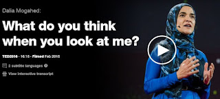 Concepts of Thinking: Geographic Perspective, Patterns and Trends
Inquiry: Why might people judge the group based on the activities of a few? Why might people judge cultural groups with one set of criteria but their own with another set?
Activity: Complete an issue analysis. Understanding the different stakeholders, their values and beliefs develop a plan of action to help reduce the problems associated with judging groups in a negative way.
TED2016 · 16:16 · Feb 2016
Concepts of Thinking: Geographic Perspective, Patterns and Trends
Inquiry: Why might people judge the group based on the activities of a few? Why might people judge cultural groups with one set of criteria but their own with another set?
Activity: Complete an issue analysis. Understanding the different stakeholders, their values and beliefs develop a plan of action to help reduce the problems associated with judging groups in a negative way.
Posted by Alexandra Pope in Nature on Tuesday, February 23, 2016

Concepts of Thinking: Spatial Significance, Patterns and Trends
Inquiry: Why does temperature change vary from place to place? How has temperature change impacted people in these different areas? How might this climate impact people in the future?
Activity: Create a map of spatial significance indicating places of greatest temperature change. Add data such as land use, human activity, environmental
characteristic to help determine impacts and make predictions if patterns continue. Communicate a possible solution/result via story map.
Vancouver Island’s hinterland attracts affordability refugees desperate to buy a family home
 Concepts of Thinking: Spatial Significance, Patterns and Trends, Interrelationships
Inquiry: Why might the housing in Vancouver be so expensive? Spatial Significance. What might some of the impacts on city policies be? Interrelationships. What might the future hold if home prices continue to climb? Patterns and Trends.

Concepts of Thinking: Spatial Significance, Patterns and Trends, Interrelationships
Inquiry: Why might the housing in Vancouver be so expensive? Spatial Significance. What might some of the impacts on city policies be? Interrelationships. What might the future hold if home prices continue to climb? Patterns and Trends.
 Concepts of Thinking: Interrelationships, Spatial Significance, Geographic Perspective
Inquiry: What might have caused the levels of phosphorus to get to levels that need to be reduced? How might Canada and the US agree to reduce the levels? What might some implications be if levels do not return to normal?
Activity: Conduct an issue analysis to help develop a potential solution to the problem. Map the extent to which the algae bloom has grown. Use water current data to determine future implications.

Concepts of Thinking: Interrelationships, Spatial Significance, Geographic Perspective
Inquiry: What might have caused the levels of phosphorus to get to levels that need to be reduced? How might Canada and the US agree to reduce the levels? What might some implications be if levels do not return to normal?
Activity: Conduct an issue analysis to help develop a potential solution to the problem. Map the extent to which the algae bloom has grown. Use water current data to determine future implications.
Peru oil spill pollutes Amazon rivers used by indigenous group BBC
 Concepts of Thinking: Spatial Significance, Interrelationships, Geographic Perspective
Inquiry: Why might oil exploration in such sensitive areas have been approved? Who might be responsible for this spill, the workers? the companies? the consumers? How might this be thoroughly cleaned up?
Activity: Collect data on the spatial significance of the area, plot where it happened, add human activity in the area. Create buffers to determine how far the spill might impact and make predictions.Complete an issue analysis of the problem to determine a possible solution. Communicate predictions and solution in a story map.

Concepts of Thinking: Spatial Significance, Interrelationships, Geographic Perspective
Inquiry: Why might oil exploration in such sensitive areas have been approved? Who might be responsible for this spill, the workers? the companies? the consumers? How might this be thoroughly cleaned up?
Activity: Collect data on the spatial significance of the area, plot where it happened, add human activity in the area. Create buffers to determine how far the spill might impact and make predictions.Complete an issue analysis of the problem to determine a possible solution. Communicate predictions and solution in a story map.
Decision on burying nuclear waste near Lake Huron delayed for more study
The Canadian Press
Published Thursday, February 18, 2016
The Canadian Press
Published Thursday, February 18, 2016
 Concepts of Thinking: Spatial Significance, Geographic Perspective,
Inquiry: How can nuclear waste be disposed of safely? What is where? How is an ideal waste disposal site selected? Why there? If not here then where should the nuclear waste be disposed of? Why Care?
Activity: Collect information on the characteristics of a nuclear waste disposal site i.e. geology of an area and map out using ArcGIS Online. Add to it data such as population, water and other relevant data (dependent on audience). Do an analysis of the map, such as creating buffers, to determine an idea location to dispose of the waste. Complete an issue analysis and the communicate via story map to the appropriate audience.
Concepts of Thinking: Spatial Significance, Geographic Perspective,
Inquiry: How can nuclear waste be disposed of safely? What is where? How is an ideal waste disposal site selected? Why there? If not here then where should the nuclear waste be disposed of? Why Care?
Activity: Collect information on the characteristics of a nuclear waste disposal site i.e. geology of an area and map out using ArcGIS Online. Add to it data such as population, water and other relevant data (dependent on audience). Do an analysis of the map, such as creating buffers, to determine an idea location to dispose of the waste. Complete an issue analysis and the communicate via story map to the appropriate audience.
US 'likely culprit' of global spike in methane emissions over last decade
 Concept of Thinking: Interrelationships, Spatial Significance. Patterns and Trends
Inquiry: Why has methane gas emissions in the USA increased so much? How might reducing methane emissions impact society?
Activity: Create an interactive map via ArcGIS Online to locate where emissions have increase and activities that contribute to increased emissions to determine the spatial significance of the issue. Can any patterns be observed? Communicate the patterns that are observed to an appropriate audience to create change.

Concept of Thinking: Interrelationships, Spatial Significance. Patterns and Trends
Inquiry: Why has methane gas emissions in the USA increased so much? How might reducing methane emissions impact society?
Activity: Create an interactive map via ArcGIS Online to locate where emissions have increase and activities that contribute to increased emissions to determine the spatial significance of the issue. Can any patterns be observed? Communicate the patterns that are observed to an appropriate audience to create change.
Turkish Air Strikes Hit PKK Camps In Northern Iraq After Ankara Bombing
 Concepts of Thinking: Geographic Perspective, Spatial Significance
Inquiry: How might the bombing impact the ongoing Syrian conflict?
Activity: Create a map (spatial journal) of the area incorporating the stakeholders and events related to the conflict and complete an issue analysis to help develop an understanding of the conflict. Communicate a potential solution to the appropriate stakeholder via story map.

Concepts of Thinking: Geographic Perspective, Spatial Significance
Inquiry: How might the bombing impact the ongoing Syrian conflict?
Activity: Create a map (spatial journal) of the area incorporating the stakeholders and events related to the conflict and complete an issue analysis to help develop an understanding of the conflict. Communicate a potential solution to the appropriate stakeholder via story map.
"Lead helps guard your health": How U.S. companies sold a toxic product
By

By

Romeo Dallaire: ISIS Can't Be Defeated Without Strategy To Help Child Soldiers
 Concepts of Thinking: Interrelationships, Geographic Perspective,
Inquiry: Where do Child Soldiers come from? How might children be "trained" to be soldiers? How might Child Soldiers be helped?
Activity: Create a chloropleth map of countries using child soldiers. Add to it country of origin for the children soldiers. Spatial Significance. Conduct an issue analysis of the issue and communicate a potential solution.
Extension: graph out statistics on Child Soldiers to determine patterns and trends and make some predictions.

Concepts of Thinking: Interrelationships, Geographic Perspective,
Inquiry: Where do Child Soldiers come from? How might children be "trained" to be soldiers? How might Child Soldiers be helped?
Activity: Create a chloropleth map of countries using child soldiers. Add to it country of origin for the children soldiers. Spatial Significance. Conduct an issue analysis of the issue and communicate a potential solution.
Extension: graph out statistics on Child Soldiers to determine patterns and trends and make some predictions.
U.N. working group suggests U.S. work on racial reconciliation By

Ceasefire Doesn’t Mean Parties 'Stop Using Weapons,' According To Syria's Assad
 Concepts of Thinking: Patterns and Trends, Interrelationship
Inquiry: How might the "powers" who implemented the cease fire in Syria react to the Syrian government not following through with the cease fire?
Activity: Complete an issue analysis of the current twist in this conflict. How should the "powers" proceed if bringing this conflict to an end is indeed the goal? Continue adding this information to a spatial journal

Concepts of Thinking: Patterns and Trends, Interrelationship
Inquiry: How might the "powers" who implemented the cease fire in Syria react to the Syrian government not following through with the cease fire?
Activity: Complete an issue analysis of the current twist in this conflict. How should the "powers" proceed if bringing this conflict to an end is indeed the goal? Continue adding this information to a spatial journal
Toxic chemicals found in beached pilot whales in Scotland
 Concepts of Thinking: Spatial Significance, Interrelationships, Patterns and Trends, Geographic Perspective
Inquiry: Why might age contribute to the increases levels of mercury and cadmium. How might increased levels of these chemicals contribute to the whales beaching themselves? Where could these chemicals have come from?
Activity: Create a spatial journal of where these whales were beached (What is where?). Add to it possible locations where mercury and cadmium could have entered the water (Why there?). As well add other locations where whales have beached themselves. Analyse the patterns and trends that may appear, investigate the stakeholders and make suggestions how to ensure this does not happen in the future (Why Care?).

Concepts of Thinking: Spatial Significance, Interrelationships, Patterns and Trends, Geographic Perspective
Inquiry: Why might age contribute to the increases levels of mercury and cadmium. How might increased levels of these chemicals contribute to the whales beaching themselves? Where could these chemicals have come from?
Activity: Create a spatial journal of where these whales were beached (What is where?). Add to it possible locations where mercury and cadmium could have entered the water (Why there?). As well add other locations where whales have beached themselves. Analyse the patterns and trends that may appear, investigate the stakeholders and make suggestions how to ensure this does not happen in the future (Why Care?).
Report on Syria conflict finds 11.5% of population killed or injured
Ian Black Middle East editor
 Concepts of thinking: Geographic Perspective, Patterns and Trends, Spatial Significane
Inquiry: At what point might it be possible for UN to label this conflict a Genocide?
Activity: Use an issue analysis chart to help develop a solution to this conflict. Map out the Stakeholder, manage the data in a spatial journal to create a visual of the spatial significance of the conflict. Communicate your developed solution in a story map to communicate to the appropriate audience...UN?
Concepts of thinking: Geographic Perspective, Patterns and Trends, Spatial Significane
Inquiry: At what point might it be possible for UN to label this conflict a Genocide?
Activity: Use an issue analysis chart to help develop a solution to this conflict. Map out the Stakeholder, manage the data in a spatial journal to create a visual of the spatial significance of the conflict. Communicate your developed solution in a story map to communicate to the appropriate audience...UN?
Report on Syria conflict finds 11.5% of population killed or injured
Ian Black Middle East editor
 Concepts of thinking: Geographic Perspective, Patterns and Trends, Spatial Significane
Inquiry: At what point might it be possible for UN to label this conflict a Genocide?
Activity: Use an issue analysis chart to help develop a solution to this conflict. Map out the Stakeholder, manage the data in a spatial journal to create a visual of the spatial significance of the conflict. Communicate your developed solution in a story map to communicate to the appropriate audience...UN?
What are the top global risks for 2016?
 Concepts of Thinking: Spatial Significance,
Geographic Perspective, Patterns and Trends
Concepts of Thinking: Spatial Significance,
Geographic Perspective, Patterns and Trends
Inquiry: How were these risks established?
Activity: Map graph and chart the data for interpretation. Make predictions on what the future risks might be and where they may be located with supporting information.

Concepts of Thinking: Spatial Significance,
Geographic Perspective, Patterns and Trends
Inquiry: How were these risks established?
Activity: Map graph and chart the data for interpretation. Make predictions on what the future risks might be and where they may be located with supporting information.
Exploring Humanitarian Law (EHL)
 Concepts of Thinking: Geographic Perspective, Spatial Significance, Interrelationships, Patterns and Trends
Activity: Use this resource to meet Geographic curriculum expectations for wide range of courses.


Concepts of Thinking: Geographic Perspective, Spatial Significance, Interrelationships, Patterns and Trends
Activity: Use this resource to meet Geographic curriculum expectations for wide range of courses.
Playlist: 5 talks on the future of food
 Concepts of Thinking: Interrelationship, Geographic Perspective
Inquiry: How might food sources change in the future? Where might our food come from in the future? How might our diets change in the future?
Activity: Create a map of where food is coming from now and then plot where it might be coming from as the climate changes. How might this change impact communities around the world?

Concepts of Thinking: Interrelationship, Geographic Perspective
Inquiry: How might food sources change in the future? Where might our food come from in the future? How might our diets change in the future?
Activity: Create a map of where food is coming from now and then plot where it might be coming from as the climate changes. How might this change impact communities around the world?
‘Dear Dad, I’m Going to Be Called a Whore’. Her Powerful Video Is Now Moving Millions.
1-in-3 women worldwide will experience physical or sexual violence in their lifetime…
 Concepts of Thinking: Patterns and Trends, Spatial Significance, Geographic Perspective, Interrelationships
Inquiry: How might a society deal with the problem of violence against women? How is it possible for people to treat people so poorly, it's 2016?
Activity: Create a spatial journal of violence against women, locally, nationally, internationally (What is where?). Explore to data for patterns and trends (Why there?). Develop an action plan that could be introduced to help reduce the incidence of violence against women locally, nationally, internationally. Communicate the results to the appropriate audience (Why care?).
1-in-3 women worldwide will experience physical or sexual violence in their lifetime…

Concepts of Thinking: Patterns and Trends, Spatial Significance, Geographic Perspective, Interrelationships
Inquiry: How might a society deal with the problem of violence against women? How is it possible for people to treat people so poorly, it's 2016?
Activity: Create a spatial journal of violence against women, locally, nationally, internationally (What is where?). Explore to data for patterns and trends (Why there?). Develop an action plan that could be introduced to help reduce the incidence of violence against women locally, nationally, internationally. Communicate the results to the appropriate audience (Why care?).
Spanish water rights fight raises fears for Ebro delta
 Concepts of Thinking: Spatial Significance, Geographic Perspective, Patterns and Trends
Inquiry: Why is the Spanish government wanting divert water? How might the diversion impact local, national, international environments?
Activity: Create a map showing precipitation patterns in the region (What is where?). Analyse the climatic factors that could contribute to the climate of this region (Why there?). Evaluate the data to make prediction one some possible consequences of the water diversion plan and communicate the results (Why Care?).
U.S. Olympic Committee Tells Athletes To Consider Not Attending Rio Games Over Zika Virus
 Concepts of Thinking: Interrelationships, Spatial Significance
Inquiry: Would it be possible that the Rio Olympics be the first in which athletes and countries boycott due to environmental concerns?
Activity: Map out where previous Olympics have been held (What is where?). Determine which ones where boycotted, potentially boycotted and why (Why there?). Evaluate for patterns and trends. Make predictions on future sites and possible concerns (Why care?).
Concepts of Thinking: Interrelationships, Spatial Significance
Inquiry: Would it be possible that the Rio Olympics be the first in which athletes and countries boycott due to environmental concerns?
Activity: Map out where previous Olympics have been held (What is where?). Determine which ones where boycotted, potentially boycotted and why (Why there?). Evaluate for patterns and trends. Make predictions on future sites and possible concerns (Why care?).

Concepts of Thinking: Spatial Significance, Geographic Perspective, Patterns and Trends
Inquiry: Why is the Spanish government wanting divert water? How might the diversion impact local, national, international environments?
Activity: Create a map showing precipitation patterns in the region (What is where?). Analyse the climatic factors that could contribute to the climate of this region (Why there?). Evaluate the data to make prediction one some possible consequences of the water diversion plan and communicate the results (Why Care?).
U.S. Olympic Committee Tells Athletes To Consider Not Attending Rio Games Over Zika Virus

Concepts of Thinking: Interrelationships, Spatial Significance
Inquiry: Would it be possible that the Rio Olympics be the first in which athletes and countries boycott due to environmental concerns?
Activity: Map out where previous Olympics have been held (What is where?). Determine which ones where boycotted, potentially boycotted and why (Why there?). Evaluate for patterns and trends. Make predictions on future sites and possible concerns (Why care?).
Asteroid mining could be space’s new frontier: the problem is doing it legally
 Concepts of Thinking: Geographic Perspective,
Interrelationships
Concepts of Thinking: Geographic Perspective,
Interrelationships
Inquiry: What types of minerals could potential be mined in space? How could it be possible to mine minerals from space? How might these extraterrestrial minerals impact the Global Environment? What might be needed to ensure that mining these minerals is legal?
Activity: Map out where these (the potential extraterrestrial) minerals can be found on earth. Do an issue analysis to determine the positions and possible solutions to this problem. Communicate the best possible solution to the appropriate audience.
 Concepts of Thinking: Geographic Perspective,
Interrelationships
Inquiry: What types of minerals could potential be mined in space? How could it be possible to mine minerals from space? How might these extraterrestrial minerals impact the Global Environment? What might be needed to ensure that mining these minerals is legal?
Activity: Map out where these (the potential extraterrestrial) minerals can be found on earth. Do an issue analysis to determine the positions and possible solutions to this problem. Communicate the best possible solution to the appropriate audience.
Rescuers race to save dozens trapped under rubble of Taiwan earthquake
 Concepts of Thinking: Spatial Significance, Patterns and Trends
Inquiry: Why were the apartments near by the collapsed building not affected to the same extent? How could this collapse have been prevented?

Concepts of Thinking: Spatial Significance, Patterns and Trends
Inquiry: Why were the apartments near by the collapsed building not affected to the same extent? How could this collapse have been prevented?
This Talking Bird Is Disappearing From the Wild

Concepts of Thinking: Interrelationships, Spatial Significance,
Inquiry: Where can these birds be found (spatial significance)? What is where? What are some of the circumstances that could be impacting these birds (interrelationships)? What is where? How could this species circumstance be improved? Why care?
Activity: Create a story map to communicate a solution to this problem.
Morocco to switch on first phase of world's largest solar plant Arthur Neslen
 Concepts of Thinking: Spatial Significance, Interrelationships
Inquiry: How was spatial significance incorporated into the decision of locating the facility? How might the facility impact local, national, international communities and their environments?
Zika Virus and Direct Relief's Partner Network Story Map.
 Concepts of Thinking: Spatial Significance, Patterns and Trends, Interrelationships
Inquiry: What might be the impacts of this virus on different communities? How might the infected children be supported in the future?
Activity: Conduct an issue analysis to develop with a possible solution and communicate it to appropriate stakeholders.

Concepts of Thinking: Spatial Significance, Interrelationships
Inquiry: How was spatial significance incorporated into the decision of locating the facility? How might the facility impact local, national, international communities and their environments?
Zika Virus and Direct Relief's Partner Network Story Map.

Concepts of Thinking: Spatial Significance, Patterns and Trends, Interrelationships
Inquiry: What might be the impacts of this virus on different communities? How might the infected children be supported in the future?
Activity: Conduct an issue analysis to develop with a possible solution and communicate it to appropriate stakeholders.
PRO/CON: Should the U.S. rely on nuclear power to fix climate change?
By

By
Palestinian families homeless as Israeli military demolishes West Bank houses Peter Beaumont in Khirbet Jenbah
 Concepts of Thinking: Spatial Significance, Geographic Perspective, Patterns and Trends, Interrelationships
Inquiry: What might the families, of the demolished homes, have to do to be able to survive being left without a home? Why would the Israeli government believe the demolishing of homes in the West Bank?
Activity: Gather and Organize data on the problem of the West Band. Use an issue analysis chart. What is Where? Interpret and analysis the data by creating a spatial journal of the problem. Why there? Evaluate and draw conclusion and devise a solution to the problem that can be share with the stakeholders. Why care?
Small business owners hope Syrian refugees can fill some long vacant positions
Dan Kelly | February 1, 2016
 Concepts of Thinking: Geographic Perspective, Interrelationships, Patterns and Trends, Spatial Significance
Inquiry: Why might there be job vacancies in an economy that has unemployment?
Concepts of Thinking: Geographic Perspective, Interrelationships, Patterns and Trends, Spatial Significance
Inquiry: Why might there be job vacancies in an economy that has unemployment?
Activity: Gather data on the Canadian economy to determine where (spatial significance) there are vacancies as well as data on where refugees/immigrants are settling in Canada, create maps to help analyse the data to find a conclusion (patterns and trends, interrelationships). Develop a proposal, if needed, to match settlement patterns with job vacancy patterns (geographic perspective).
The Emerging Arctic
CFR InfoGuide Presentation
 Concepts of Thinking: Geographic Perspective, Spatial Significance
Activity: Students create a spatial journal to map out the data (spatial significance) What is where? , complete an issues analysis chart (Geographic Perspective) Why there? , create a story map to communicate the solution. Why care?
Dan Kelly | February 1, 2016

Concepts of Thinking: Geographic Perspective, Interrelationships, Patterns and Trends, Spatial Significance
Inquiry: Why might there be job vacancies in an economy that has unemployment?
Activity: Gather data on the Canadian economy to determine where (spatial significance) there are vacancies as well as data on where refugees/immigrants are settling in Canada, create maps to help analyse the data to find a conclusion (patterns and trends, interrelationships). Develop a proposal, if needed, to match settlement patterns with job vacancy patterns (geographic perspective).
The Emerging Arctic
CFR InfoGuide Presentation
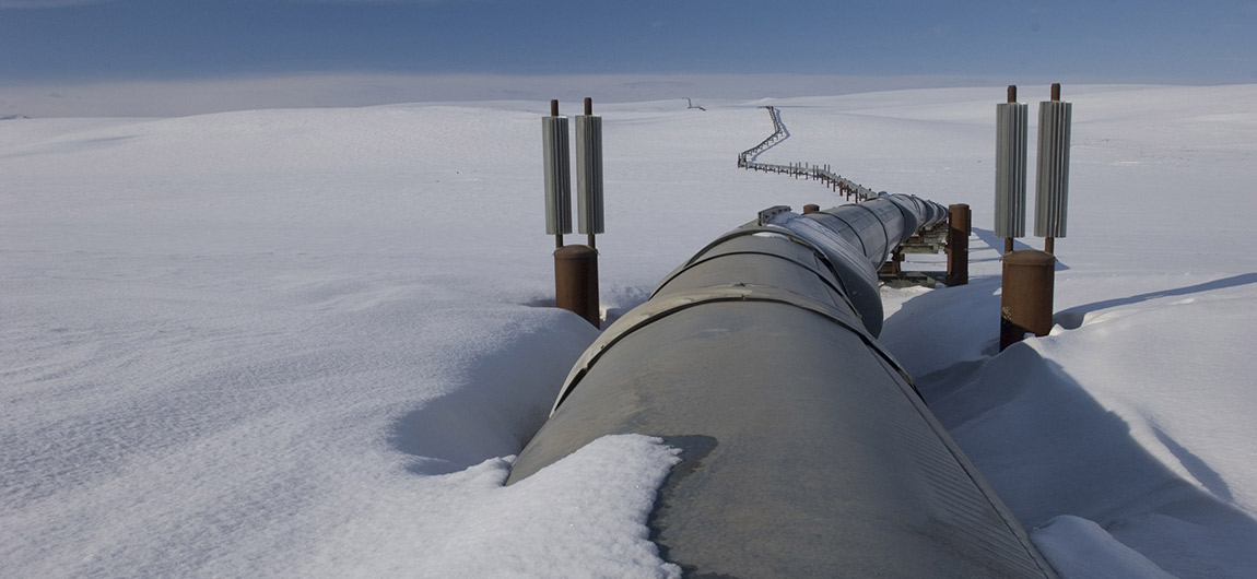
Concepts of Thinking: Geographic Perspective, Spatial Significance
Activity: Students create a spatial journal to map out the data (spatial significance) What is where? , complete an issues analysis chart (Geographic Perspective) Why there? , create a story map to communicate the solution. Why care?
Small business owners hope Syrian refugees can fill some long vacant positions
Final agreement reached to protect B.C.’s Great Bear Rainforest
BELLA BELLA, B.C. — The Globe and Mail
 Concepts of Thinking: Spatial Significance, Geographic Perspective, Patterns and trends
Inquiry: What is the spatial significance of the Great Bear Rain-forest? What is where? Why is this agreement so important? Why there? How has this agreement met the needs of the different stakeholders? How might this agreement reduce the impact on the Rain-forest? Why care?
BELLA BELLA, B.C. — The Globe and Mail

Concepts of Thinking: Spatial Significance, Geographic Perspective, Patterns and trends
Inquiry: What is the spatial significance of the Great Bear Rain-forest? What is where? Why is this agreement so important? Why there? How has this agreement met the needs of the different stakeholders? How might this agreement reduce the impact on the Rain-forest? Why care?
El Niño means glaciers in the Andes are melting at record rates
 Concepts of Thinking: Interrelationships, Spatial Significance, Patterns and Trends
Inquiry: Which parts of the Andes are impacted the greatest? What is where? What might have caused the acceleration in the melting of the Glaciers? Why there? How might this reduction impact communities? What could be the best solution to protect the Andes mountain glaciers? Why care?
Activity: Map (ArcGIS Online)the extent of the current glacier (see map above) gather data of extent of glacier for the past 60 years and map it. What are some of the patterns that can be seen. What is the spatial significance of the area. Make prediction on possible solutions to the problem.

Concepts of Thinking: Interrelationships, Spatial Significance, Patterns and Trends
Inquiry: Which parts of the Andes are impacted the greatest? What is where? What might have caused the acceleration in the melting of the Glaciers? Why there? How might this reduction impact communities? What could be the best solution to protect the Andes mountain glaciers? Why care?
Activity: Map (ArcGIS Online)the extent of the current glacier (see map above) gather data of extent of glacier for the past 60 years and map it. What are some of the patterns that can be seen. What is the spatial significance of the area. Make prediction on possible solutions to the problem.
Scientists: "Doomsday Clock" reflects grave threats to world
 Concepts of Thinking: Geographic Perspective, Interrelationships
Inquiry: How is the criteria determined to measure such an event? What might be the motivation for organizations to support such research?
Access to family planning services is vital to poverty reduction and the success of the sustainable development goals (SDGs).
 Concepts of Thinking: Interrelationships, Patterns and Trends, Spatial Significance
Inquiry: How could the type of family planning contribute to meeting SDG's? What might be needed to ensure that SDG's are meet? Why might it be important to meet SDG's?
Activity: Use the data found at Guttmacher Institute and to create a story map (ArcGIS On line, spatial journal) what is happening around the world regarding family planning to identify spatial significance (What is where?), patterns and trends, interrelationships (Why there?), and Geographic perspective (Why care?). Now act on the results of the inquiry.

Concepts of Thinking: Geographic Perspective, Interrelationships
Inquiry: How is the criteria determined to measure such an event? What might be the motivation for organizations to support such research?
Access to family planning services is vital to poverty reduction and the success of the sustainable development goals (SDGs).

Concepts of Thinking: Interrelationships, Patterns and Trends, Spatial Significance
Inquiry: How could the type of family planning contribute to meeting SDG's? What might be needed to ensure that SDG's are meet? Why might it be important to meet SDG's?
Activity: Use the data found at Guttmacher Institute and to create a story map (ArcGIS On line, spatial journal) what is happening around the world regarding family planning to identify spatial significance (What is where?), patterns and trends, interrelationships (Why there?), and Geographic perspective (Why care?). Now act on the results of the inquiry.
Emergency planners set the stage for "Big One" quake in Pacific Northwest
By 01.28.16
 Concepts of Thinking: Patterns and Trends, Interrelationships, Spatial Significance
Inquiry: What might be the best relocation response be for emergency crew to the "Big One"?
Activity: Gather data to map (ArcGIS Online) out earthquake activity and create buffers to represent the magnitude (How far it can be felt). What is where? Add in data such as plate boundaries to help determine Why there? Add in cities to determine who might be impacted and where possible safe zone may be located. Devise a response plane to the "Big One". Why care?
By 01.28.16

Concepts of Thinking: Patterns and Trends, Interrelationships, Spatial Significance
Inquiry: What might be the best relocation response be for emergency crew to the "Big One"?
Activity: Gather data to map (ArcGIS Online) out earthquake activity and create buffers to represent the magnitude (How far it can be felt). What is where? Add in data such as plate boundaries to help determine Why there? Add in cities to determine who might be impacted and where possible safe zone may be located. Devise a response plane to the "Big One". Why care?
Will new maternity law help keep Indian women in work?
 Concepts of Thinking: Interrelationships, Spatial Significance, Geographic Perspective, Patterns and Trends
Inquiry: How has the maternity leave in India changed, interrelationship? How could a common maturity leave policy for working women be developed to better support the women, geographic perspective? How does Canada's maternity leave policy compare?
Activity: Create a spatial journal of maternity leave policies. Analyse to determine Spatial Significance, Patterns ad Trends. What is where? Why there? Devise a plan to help policy makers create maternity leave policies that can benefit all stakeholders. Why care?

Concepts of Thinking: Interrelationships, Spatial Significance, Geographic Perspective, Patterns and Trends
Inquiry: How has the maternity leave in India changed, interrelationship? How could a common maturity leave policy for working women be developed to better support the women, geographic perspective? How does Canada's maternity leave policy compare?
Activity: Create a spatial journal of maternity leave policies. Analyse to determine Spatial Significance, Patterns ad Trends. What is where? Why there? Devise a plan to help policy makers create maternity leave policies that can benefit all stakeholders. Why care?
15 Endangered Cities That May Be Flooded By Climate Change
by
 Concepts of Thinking: Spatial Significance, Patterns and Trends, Interrelationships
Inquiry: Where will the residents city go and how do they get there when/if this happens? Why is this a potential threat for so may people?
Problem Based Learning: Use ArcGIS Online to create a map predicting the impacts of rising sea levels. See Mapping Our World
by

Concepts of Thinking: Spatial Significance, Patterns and Trends, Interrelationships
Inquiry: Where will the residents city go and how do they get there when/if this happens? Why is this a potential threat for so may people?
Problem Based Learning: Use ArcGIS Online to create a map predicting the impacts of rising sea levels. See Mapping Our World
I Support The Energy East Pipeline As A Pragmatic Environmentalist
 Concepts of Thinking: Geographic Perspective, Interrelationships, Spatial Significance, Patterns and Trends
Inquiry: How could our society, the world, actually become an oil free society? What might some of the consequences be?
Problem Based Learning: Gather information on the stakeholders developing geographic perspective. Create a spatial journal of this issue to determine spatial significance. Analysis the patterns and trends and develop a solution that would work best for the majority of the stakeholders, including the environment.

Concepts of Thinking: Geographic Perspective, Interrelationships, Spatial Significance, Patterns and Trends
Inquiry: How could our society, the world, actually become an oil free society? What might some of the consequences be?
Problem Based Learning: Gather information on the stakeholders developing geographic perspective. Create a spatial journal of this issue to determine spatial significance. Analysis the patterns and trends and develop a solution that would work best for the majority of the stakeholders, including the environment.
Could What Happened in Flint Happen Anywhere?
 Concepts of Thinking: Geographic Perspective, Interrelationships, Spatial Significance
Inquiry: How did the water get so contaminated it started to break down the pipes made to transport it? How can this water problem be solved? How might this issue impact people around the world?
PHOTOGRAPH BY WILLIAM ARCHIE, DETROIT FREE PRESS/ZUMA/CORBIS
Problem Based Learning: What is where? Why there? Why care? Create an Issues Analysis Chart for this problem. What out what is known in ArcGIS Online i.e. where does the water come from, what goes into the water i.e human activities, communities and anything else that may help with the analysis. Make predictions and develop a potential solution to the Flint water crisis.

Concepts of Thinking: Geographic Perspective, Interrelationships, Spatial Significance
Inquiry: How did the water get so contaminated it started to break down the pipes made to transport it? How can this water problem be solved? How might this issue impact people around the world?
PHOTOGRAPH BY WILLIAM ARCHIE, DETROIT FREE PRESS/ZUMA/CORBIS
Problem Based Learning: What is where? Why there? Why care? Create an Issues Analysis Chart for this problem. What out what is known in ArcGIS Online i.e. where does the water come from, what goes into the water i.e human activities, communities and anything else that may help with the analysis. Make predictions and develop a potential solution to the Flint water crisis.
Solar solutions
How solar-powered water pumps are helping Pakistani farmers adjust to climate change
 Concepts of Thinking: Interrelationships, Spatial Significance
Inquiry: How can some of the poorest farmers adapt to climate change?
Activity: Use ArcGIS Online to create a map of the area indicating the pattern of rain fall in the area, access to water via rivers and lakes, population distribution to start to analysis the spatial significance and interrelationship to develop a solution to the problem of access to water.
Extension activities: Download the workbook

Concepts of Thinking: Interrelationships, Spatial Significance
Inquiry: How can some of the poorest farmers adapt to climate change?
Activity: Use ArcGIS Online to create a map of the area indicating the pattern of rain fall in the area, access to water via rivers and lakes, population distribution to start to analysis the spatial significance and interrelationship to develop a solution to the problem of access to water.
Extension activities: Download the workbook
EU border controls: Schengen scheme on the brink after Amsterdam talks

Ian Traynor in Brussels andHelena Smith in Athens
Concepts of Thinking: Geographic Perspective, Spatial Significance, Patterns and Trends
Inquiry: What is the Schengen scheme? How might the Schengen scheme impact refugees?
Activity: Problem Based Learning, ideal for World Issues, create an Issues Analysis Chart of the stakeholders to help determine geographic perspective. Record this information in a spatial journal and identify the spatial significance of the locations. What is where? Analysis the spatial journal to determine the patterns. Why there? What might a possible solution be to this issue? Use your evidence to support the solution. Why care? Write a letter describing the solution to one of the stakeholders who has influence enough to evoke change. Now what?
Fifth dead whale found on Lincolnshire beach Josh Halliday North of England correspondent Monday 25 January 2016 14.26 GMT

Concepts of Thinking: Spatial Significance, Patters and Trends, Interrelationship
Inquiry: What might have caused these whales to become beached? How might this event be addressed to prevent it from happening again in the future?
Activity: Use ArcGIS Online to map out where the whales went aground, spatial significane. Add in human activity in the area. What might some of the interrelationships be? Can a pattern be found? Add in some atmospheric and water data. What might some observations and conclusions be from adding in this data?
Tomato pickers persuade companies to sign on to human rights movement
By
 Inquiry: Why is this issue concentrated where it is? What is where? What circumstances a occurred to allow this process to continue? Why there? How might the pattern of worker treatment be addressed? Why care?
Extension Inquiry: What might tomato pickers working conditions be in other parts of the world and how are these conditions addressed?
Inquiry: Why is this issue concentrated where it is? What is where? What circumstances a occurred to allow this process to continue? Why there? How might the pattern of worker treatment be addressed? Why care?
Extension Inquiry: What might tomato pickers working conditions be in other parts of the world and how are these conditions addressed?
By

Inquiry: Why is this issue concentrated where it is? What is where? What circumstances a occurred to allow this process to continue? Why there? How might the pattern of worker treatment be addressed? Why care?
Extension Inquiry: What might tomato pickers working conditions be in other parts of the world and how are these conditions addressed?
Oceans to have more plastic than fish by 2050: Report

Concepts of Thinking: Interrelationships, Patterns and Trends, Geographic Perspective, Spatial Significance
Problem Based Inquiry: How might the plastic be removed from the oceans? Why is ti that only 5% of plastics is recycled?

Concepts of Thinking: Interrelationships, Patterns and Trends, Geographic Perspective, Spatial Significance
Problem Based Inquiry: How might the plastic be removed from the oceans? Why is ti that only 5% of plastics is recycled?
2015 smashes record for hottest year, final figures confirm
 Concepts of Thinking: Patterns and Trends, Spatial Significance,
Inquiry: What was so special, environmentally, that could have caused 2015 to break all heat records?
Activity: Map out areas that showed the greatest temperature difference.

Concepts of Thinking: Patterns and Trends, Spatial Significance,
Inquiry: What was so special, environmentally, that could have caused 2015 to break all heat records?
Activity: Map out areas that showed the greatest temperature difference.
Valentino's African-Inspired Spring 2016 Campaign Accused Of Cultural Appropriation
 Concepts of Thinking: Interrelationships, Spatial Significance, Patterns and Trends
Inquiry Questions: Why might copying culturally significant fashion be considered Cultural Appropriation? How might it be possible to use other cultural influences in a respectful manner?
Problem Based Learning: Develop a strategy that fashion houses/designers can follow to reduce cultural appropriation but at the same time allow for the appreciation of the cultural dress.

Concepts of Thinking: Interrelationships, Spatial Significance, Patterns and Trends
Inquiry Questions: Why might copying culturally significant fashion be considered Cultural Appropriation? How might it be possible to use other cultural influences in a respectful manner?
Problem Based Learning: Develop a strategy that fashion houses/designers can follow to reduce cultural appropriation but at the same time allow for the appreciation of the cultural dress.
Zika virus up date:
Hawaii baby born with small head had prior Zika infection

Zika virus prompts travel warning for pregnant Canadians
By: Sheryl Ubelacker The Canadian Press, Published on Fri Jan 15 2016
 Concepts of Thinking: Patterns and Trends, Spatial Significance, Interrelationships
Inquiry: What are the climatic conditions that that allow for the transmission from mosquito to humans? What is where? Where on Earth are these conditions found? Why there? How might the transmission of the Zika virus be stopped? If it can't be stopped how might transmission be reduced Why care?
Activity: Create a spatial journal or story map show when and where (places) the virus has spread to. Determine which other places (spatial significance) around the world have similar climatic conditions (interrelationships) where the virus may flourish and locate them on the map. Make some observations to determine patterns and trends to help the medical industry reduce infection rates. compare with an industry map.

Alex — the first January hurricane since 1938 — bears down on island nation with 140 km/h winds
 Concepts of Thinking: Interrelationships, Spatial Significance, Patterns and Trends
Activity Idea: Use Windyty to get up to date information on Alex. Using ArcGIS Online, analyze the weather patterns to determine where Alex may move to. What has contributed to the development of such a storm (Why there)? Are there any locations that need to be worried I (What is where)? How might be worried about the storm and what actions/percautions might be undertaken (Why care)?

Earthquakes in Alberta to become more frequent and stronger, expert says
 Concepts of Thinking: Spatial Significance, Patterns and Trends, Interrelationship, Geographic Perspective
Activity Idea: Identify the problem, determine the perspectives (What is where? Why there?), and come up with potential solution for the issue (Why care?). Communicate (including maps) the solution to an appropriate audience.

Fox Creek fracking operation closed indefinitely after earthquake
 Concepts of Thinking: Geographic Perspective, Spatial Significance
Activity Idea: Use ArcGIS Online to create a map of Alberta, near Fox River. Use layers such as fault lines, cities, transportation routes, etc. Place on it the the epicentre and the location of the fracking.
Inquiry Question: How might the fracking activity have contributed to the earthquake near Fox Creek? What might be a solution to the fracking issue?

Inquiry Question: How might the fracking activity have contributed to the earthquake near Fox Creek? What might be a solution to the fracking issue?
Mapping changes to the World’s urban population between 1950 – 2030

PRO/CON: Will eating fewer pork chops help cool our climate? By 01.11.16
South Korean animal rights activists wearing livestock masks stage a rally for farm animals slaughtered due to foot-and-mouth disease and bird flu, encouraging people to be vegetarians, Seoul, South Korea, Feb. 6, 2011. Photo: AP/ Lee Jin-man
 Concepts of Thinking: Interrelationships, Geographic Perspective, Spatial Significance, Patterns and Trends
Ideal for World Issues
Lesson Idea: Create an issues analysis chart to help determine the different position on this issue. Use ArcGIS Online to map out where the livestock is being grown. Use proportional symbols to indicate the number and use colour to differentiate the type of livestock. Add in the destination information to the map. What are the patterns and trends of this issue? Why is it that some countries consume more livestock than other countries? What is the best solution for the Earth, for the people? What needs to be done to implement this solution?
UNICEF Humanitarian Action for Children 2015
 Concepts of Thinking: Interrelationships, Geographic Perspective
Inquiry Questions: From a graphic perspective, why was this situation aloud to develop? How can countries of the world contribute to rectifying this situation?

Concept of Thinking: Spatial Significance,
Patterns and Trends
Inquiry Questions: What is the spatial significance of the countries in crisis? How might this pattern of countries in crisis change over time?
Gather and Organize: what other information that might be needed to solve this situation
Activity Idea: Create a spatial journal (digital or black-line master) using the charts in the report to create layers. Look for patterns and trends of countries and the amount of funds provided. Create a layer to indicate the reason why the children are in crisis eg. conflict, environmental, political, economic, or a combination. Add in other information i.e. population size, GDP etc to determine if there is any correlation to the funding. How does the type of crisis or the spatial significance impact the funding?
South Korean animal rights activists wearing livestock masks stage a rally for farm animals slaughtered due to foot-and-mouth disease and bird flu, encouraging people to be vegetarians, Seoul, South Korea, Feb. 6, 2011. Photo: AP/ Lee Jin-man

Concepts of Thinking: Interrelationships, Geographic Perspective, Spatial Significance, Patterns and Trends
Ideal for World Issues
Lesson Idea: Create an issues analysis chart to help determine the different position on this issue. Use ArcGIS Online to map out where the livestock is being grown. Use proportional symbols to indicate the number and use colour to differentiate the type of livestock. Add in the destination information to the map. What are the patterns and trends of this issue? Why is it that some countries consume more livestock than other countries? What is the best solution for the Earth, for the people? What needs to be done to implement this solution?
UNICEF Humanitarian Action for Children 2015


NASA Examines Global Impacts of the 2015 El Niño Credits: NASA
 Concepts of Thinking: Interrelationships, Spatial Significance, Patterns and Trends
Inquiry Questions: How does El Nino impact the interrelationship between humans and the environment? How does spatial significance contribute to the impacts of El Nino? How might patterns and trends of this environmental event be used to reduce its impacts?
Activity idea: Have students gather and organize data on El Nino to develop ideas into how to reduce its impacts on vulnerable communities around the world.

African demography
The young continent
With fertility rates falling more slowly than anywhere else, Africa faces a population explosion | MERTULE MARIAM, ETHIOPIA |
 Concepts of Thinking: Patterns and Trends, Spatial Significance, Geographic Perspective
Inquiry Questions: How might the population change impact the geographic perspective? How is the spatial significance of Africa impacting the population trends? How might the patterns and trends of the population of the continent of Africa impact different societies? How might population growth rate compare in different parts of the continent? What is spatial significant about the regions that are growing fast, regions that are growing slowly?
Six graphics that explain climate change Concepts of Thinking: Interrelationships, Patterns and Trends, Spatial Significance, Geographic Perspective
Inquiry Questions: What is the problem with Climate Change (What Is Where?)? What is the spatial significance of locations impacted the most by Climate Change (What Is Where?)? Why is Climate Change happening (Why Care?)? From a geographic perspective, what are the effects of Climate Change in my community? Looking at patterns and trends, what will the future look like as a result of Climate Change? What are possible solutions to the Climate Change problem ?

Concepts of Thinking: Patterns and Trends, Spatial Significance, Geographic Perspective
Inquiry Questions: How might the population change impact the geographic perspective? How is the spatial significance of Africa impacting the population trends? How might the patterns and trends of the population of the continent of Africa impact different societies? How might population growth rate compare in different parts of the continent? What is spatial significant about the regions that are growing fast, regions that are growing slowly?
Six graphics that explain climate change

Concepts of Thinking: Interrelationships, Patterns and Trends, Spatial Significance, Geographic Perspective
Inquiry Questions: What is the problem with Climate Change (What Is Where?)? What is the spatial significance of locations impacted the most by Climate Change (What Is Where?)? Why is Climate Change happening (Why Care?)? From a geographic perspective, what are the effects of Climate Change in my community? Looking at patterns and trends, what will the future look like as a result of Climate Change? What are possible solutions to the Climate Change problem ?
 Concepts of Thinking: Interrelationships, Spatial Significance, Patterns and Trends
Inquiry Questions: How does spatial significance contribute to the power and destruction of the Typhoon? How could buildings be built to withstand such Typhoons (Interrelationships)? How can people prepare for Typhoons to help reduce the risk/damage?
Activity Idea: Have students use ArcGIS Online or black-line master to create a spatial journal of the Typhoons that have hit this area over the past 10 years. Are there an Patterns that can be observed? How can you account for this pattern?
 Concepts of Thinking: Interrelationships, Spatial Significance, Patterns and Trends
Hyeon Soo Lim: Canadian pastor given life sentence in North Korea

Concepts of Thinking: Geographic Perspective, Interrelationship
Inquiry Questions: Why might someone be imprisoned for conducting business, something that they had been doing legitimately for a long time? What might be a consequence of the Canadian Government getting involved? How could such action be justified in Canada? What other information might be need to solve this problem?
Hyeon Soo Lim: Canadian pastor given life sentence in North Korea
Concepts of Thinking: Geographic Perspective, Interrelationship
Inquiry Questions: Why might someone be imprisoned for conducting business, something that they had been doing legitimately for a long time? What might be a consequence of the Canadian Government getting involved? How could such action be justified in Canada? What other information might be need to solve this problem?
Canada's Most Expensive Places To Buy A Home Illustrated In 1 Infographic
Posted: Updated:
 Inquiry Questions: What might account for such a variation in housing prices in Canada? How might housing price change in the future?
dotearth.blogs.nytimes.com

Concepts of Thinking: Geographic Perspective, Spatial Significance, Patterns and Trends
Have students evaluate the different stakeholders to determine the Geographic Perspective on the issue. Have students analyse the Patterns and Trends of the Climate Change to make prediction regarding the Paris Accord 2015.
Population Matters This website can be a good resource for the World Issues course as it incorporates the Geographic Concepts of Thinking. Students could easily map out locations relating to an issue to start to determine Spatial Significance, look at Patterns and Trends, evaluate the Geographic Perspective, and outline Interrelationships of an issue.
Posted: Updated:
 Inquiry Questions: What might account for such a variation in housing prices in Canada? How might housing price change in the future?
 dotearth.blogs.nytimes.com

Concepts of Thinking: Geographic Perspective, Spatial Significance, Patterns and Trends
Have students evaluate the different stakeholders to determine the Geographic Perspective on the issue. Have students analyse the Patterns and Trends of the Climate Change to make prediction regarding the Paris Accord 2015.
Population Matters

In post-OPEC world, companies look outside Alberta to greener pastures

Concepts of Thinking: Geographic Perspective, Spatial Significance, Patterns and Trends
Inquiry question: Why is Alberta oil not considered green oil? How will this shift in thinking impact Alberta's economy? How might the Alberta government protect it's economic interests?
Claudia Cattaneo | December 9, 2015 2:28 PM ET
Why Boat Refugees Don't Fly! - Factpod #16

Concepts of Thinking: Spatial Significance, Geographic Perspective, Patterns and Trends
Ideal for the World Issues Course.
Inquiry Question: How can the EU directive 2001/51/EC? Where does the responsibility lie regarding the deaths of refugees that result from water crossings? Why hasn't there been a drop in refugees attempting to flee the crisis by crossing dangerous water ways?
Published on Apr 22, 2015
This shows you why the refugees crossing the mediterranean by boat, can't just fly to Europe
Where Are the Syrian Refugees? - Factpod #17
 Concepts of Thinking: Spatial Significance, Geographic Perspective, Patterns and Trends
Ideal for the World Issues course.
Inquiry Questions: What might governments do to allow increased Syrian refugees into the EU and other parts of the World?
Published on Jun 9, 2015
After the tragic crisis in Syria, more than half of all Syrians have left their homes. Where are they?

This shows you why the refugees crossing the mediterranean by boat, can't just fly to Europe
After the tragic crisis in Syria, more than half of all Syrians have left their homes. Where are they?
Changing Climate Change: Solutions
Tackling climate change is a global issue and in the run up to the UN climate change conference in Paris most of the world's countries have put forward proposals to do their bit.
 Concepts of Thinking: Interrelationships, Spatial Significance
Inquiry Question: What might other solutions look like in other parts of the world?
Source: BBC World Service, posted Nov. 30th.

Can Middle East tourism ever recover?
The Islamic world’s mystery and riches once attracted droves of western holidaymakers. But terrorism has devastated the industry in Egypt and Tunisia – and even countries untouched by conflict. Is there any way back? Kevin Rushby
 Concepts of Thinking: Geographic Perspective, Patterns and Trends,
Activity idea: have students investigate the different stakeholders of the issue, their values, beliefs and locations (create a map) and then come up with possible impacts and solutions to the situation.

More than 100 jade hunters killed in landslide at Myanmar mine
 Concepts of Thinking: Spatial Significance, Geographic Perspective, Patterns and Trends
Inquiry question: Why would workers live in such hunts, near the tailings from the mining? How are the profits of Jade mining distributed? How could the workers get access to these profits?

Transgender woman found dead in all-male prison
This article is ideal for a World Issues class discussion. This is a sensitive topic so be aware of the readiness of your students to discuss such a subject.
 Concepts of Thinking: Geographic Perspective, Spatial Significance
Inquiry question: What might have led to this women to having her human rights over looked? How can the public insure this does not happen in Canada?
Syrian Refuges Crisis, coming to Canada?
To put things in perspective regarding the Syrian Refugee Crisis and what the Canadian Government would like to do.
 Concepts of Thinking: Patterns and Trends, Spatial Significance
Inquiry question: What might the impacts be on the existing security infrastructure? How is it be determined where in Canada these new comers might be relocated?
image source: unknown

Farmers bear brunt of South Africa’s severe drought: 'All we can do is pray
 Concepts of Thinking: Spatial Significance, Patterns and Trends, Interrelationships, Geographic Perspective
Inquiry Question: Why is this extreme weather event happening in South Africa? What can be done to help reduce the impact of this extreme weather event? How will the weather event impact local communities?
Simon Allison in Heidelberg

"Welcome to RinkWatch, where backyard skating meets environmental science!" And Geography
 Concept of Thinking: Spatial Significance, Patterns and Trends
Activity idea: Watch and keep track (spatial journal) of weather situations across Canada and where rinks are opening and for how long they are open.
Inquiry questions: How might climate change impact rinks in Canada? What could this impact look like?
Did you know that the TDSB has a rich and growing Adult Education program? This article, from The Toronto Star, highlights some of the adult students who participated in the first-ever continuing education soccer tournament on November 5, 2015 at Downsview’s famous Hanger.

Activity idea: This article would be an ideal piece to use with your students to access not only Geographic concepts of thinking, but also spatial skills.
Concept of Thinking: Spatial Significance, Patterns and Trends
Activity idea: Watch and keep track (spatial journal) of weather situations across Canada and where rinks are opening and for how long they are open.
Inquiry questions: How might climate change impact rinks in Canada? What could this impact look like?
Did you know that the TDSB has a rich and growing Adult Education program? This article, from The Toronto Star, highlights some of the adult students who participated in the first-ever continuing education soccer tournament on November 5, 2015 at Downsview’s famous Hanger.

Afghan woman stoned to death for alleged adultery Sune Engel Rasmussen
Warning to teachers: This reading may be very triggering to students who have experienced this at the community or home level. Please allow your students to prepare themselves emotionally for the difficult subject matter.
 Concepts of thinking: Geographic Perspective
Inquiry question: What happens in Canada when a person is suspected of committing adultery? Create a T-chart to compare the Canadian perspective with the perspective from the reading
Further Inquiry: Does the penalty reflect the crime? Could a man be sentenced in the same manner?
Activity: Investigate the different perspectives of the issue by evaluating their values and beliefs. Discuss in groups the different perspectives to come up with a solution to the problem.
He Took a Camera to a Remote Area In Greenland. And What He Recorded Is Simply Terrifying. 
 Concepts of Thinking: Patterns and Trends, Interrelationships
Warning to teachers: This reading may be very triggering to students who have experienced this at the community or home level. Please allow your students to prepare themselves emotionally for the difficult subject matter.

Inquiry question: What happens in Canada when a person is suspected of committing adultery? Create a T-chart to compare the Canadian perspective with the perspective from the reading
Further Inquiry: Does the penalty reflect the crime? Could a man be sentenced in the same manner?
Further Inquiry: Does the penalty reflect the crime? Could a man be sentenced in the same manner?
Activity: Investigate the different perspectives of the issue by evaluating their values and beliefs. Discuss in groups the different perspectives to come up with a solution to the problem.
He Took a Camera to a Remote Area In Greenland. And What He Recorded Is Simply Terrifying.
 Concepts of Thinking: Patterns and Trends, Interrelationships
Who backs whom in the Syrian conflict
 Concepts of Thinking: Geographic Perspective, Spatial Significance
Inquiry question: How does spatial significance influence stakeholder support?
Activity idea: Do an issue analysis: Stakeholders position, their values, and beliefs. Develop a potential solution based on the issue analysis.
As wars rage in Libya, Syria and Yemen, Ban Ki-moon and Peter Maurer call for states to help refugees, rein in armed groups and end heavy weapon use in populated areas
A young Yemeni peers through a gap in a makeshift tent at a displaced person’s camp in the country’s Amran province. Photograph: Yahya Arhab/EPA

Concepts of Thinking: Geographic Perspective
Inquiry questions:
Why are some stakeholders in the conflict ignoring international law?
Why might other stakeholders not feel they are able to uphold international law?
How might this conflict end?

Concepts of Thinking: Geographic Perspective, Spatial Significance
Inquiry question: How does spatial significance influence stakeholder support?
Activity idea: Do an issue analysis: Stakeholders position, their values, and beliefs. Develop a potential solution based on the issue analysis.
As wars rage in Libya, Syria and Yemen, Ban Ki-moon and Peter Maurer call for states to help refugees, rein in armed groups and end heavy weapon use in populated areas

As Indonesia's Annual Fires Rage, Plenty Of Blame But No Responsibility NOVEMBER 01, 2015 ANTHONY-KUHN NPR
Abdul Qodir/AFP/Getty Images

Concepts of Thinking: Interrelationship, Geographic Perspective, Spatial Significance, and Patterns and Trends
Inquiry: Where did the fires start? What is where?
Why do these fires occur yearly? Why there?
How are these fires impacting local and global populations? Why care?
How might the occurrence of these fires be prevented? Why care?
Activity: Map out the location of the palm oil plantations. Answer What is where? Why there? why care? Add to the that map the destination locations of palm oil products. Answer What is where? Why there? Why care?
Can students come up with a potential solution to the yearly occurrence while taking into account the different stakeholders?
The NASA GEOS-5 model is sensitive enough to show sulfur dioxide emissions from ships moving along major shipping lanes.
 Concepts of Thinking: Interrelationship, Spatial Significance, and Patterns and Trends
Inquiry question:
What is spatially significant about the shipping lanes? What is where?
Why do the shipping lanes follow the pattern that they do? Why there?
How will sulfur dioxide impact the interrelationship of people living near the shipping lanes? Why care?
Abdul Qodir/AFP/Getty Images

Concepts of Thinking: Interrelationship, Geographic Perspective, Spatial Significance, and Patterns and Trends
Inquiry: Where did the fires start? What is where?
Why do these fires occur yearly? Why there?
How are these fires impacting local and global populations? Why care?
How might the occurrence of these fires be prevented? Why care?
Activity: Map out the location of the palm oil plantations. Answer What is where? Why there? why care? Add to the that map the destination locations of palm oil products. Answer What is where? Why there? Why care?
Can students come up with a potential solution to the yearly occurrence while taking into account the different stakeholders?
The NASA GEOS-5 model is sensitive enough to show sulfur dioxide emissions from ships moving along major shipping lanes.

Concepts of Thinking: Interrelationship, Spatial Significance, and Patterns and Trends
Inquiry question:
What is spatially significant about the shipping lanes? What is where?
Why do the shipping lanes follow the pattern that they do? Why there?
How will sulfur dioxide impact the interrelationship of people living near the shipping lanes? Why care?
China ends one-child policy, will allow two children for all couples
 Concepts of Thinking: Geographic Perspective, Patterns and Trends, and Interrelationship.
Inquiry questions: How might this policy impact of local and global demographic patterns and trends?
How might this population policy impact the interrelationship with humans and the environment?
BEIJING — The Globe and Mail
Published
Last updated
News / Atkinson Series

Concepts of Thinking: Geographic Perspective, Patterns and Trends, and Interrelationship.
Inquiry questions: How might this policy impact of local and global demographic patterns and trends?
How might different geographic perspectives viewed this policy change?
How might this population policy impact the interrelationship with humans and the environment?
BEIJING — The Globe and Mail
Published
Last updated
News / Atkinson Series
Earthquake rattles remote areas of Afghanistan and Pakistan, at least 263 dead
'Our top priority is to help those affected because of the earthquake,' Pakistani official says
The Associated Press Posted: Oct 26, 2015 5:39 AM ET
Concepts of Thinking: Spatial Significance, Geographic Perspective, Interrelationship
Lesson idea: Map out location of the epicentre and add in communities. Is there any relationship?
Inquiry question: Why might people live in an area that has the potential for such large earthquakes? What might be done to ensure such devastation is minimized in the future?

 Concepts of Thinking: Geographic Perspective, Interrelationships, and Patterns and Trends
Inquiry question: How might the increased number of foreign workers impact local communities?
Source: Toronto Star
Curriculum connection Strand D: Changing Populations, Grade 9 Geography
Concepts of Thinking: Patterns and Trends, Spatial Significance, Geographic Perspective, and Interrelationships

Concepts of Thinking: Geographic Perspective, Interrelationships, and Patterns and Trends
Inquiry question: How might the increased number of foreign workers impact local communities?
Source: Toronto Star

Immigration maps
The following maps and charts are based upon data obtained from Citizenship and Immigration Canada, which covers 2001-2011. The data contains records of applications to immigrate to Canada, including year, country of birth and immigration category. Please refer to our glossary for a description of all these categories, and to our welcome page for more information about the maps and charts.

Concepts of Thinking: Spatial Significance, Geographic Perspective, Patterns and Trends
Inquiry Question: Where is Canada receiving the most immigration applications from? Why are these countries send so many applications? Why should Canada be looking at these applications?

Immigration timeline

Concept of Thinking: Spatial Significance, Geographic Perspective, Patterns and Trends
Lesson idea: create a spatial journal using the information from the time line to facilitate the analysis of the information.
Inquiry question: What are patterns appear? How does location (spatial significance) impact Canada’s Immigration History? How could Geographic Perspective impact Immigration Policy?
Justin Trudeau begins first full day as Canada's prime minister-designate
 Concepts of Thinking: Geographic Perspective
Lesson Idea: Minds On-What Is Where? Why There? Why Care?
Canada’s wealthiest 86 people now own as much as the 11.4 million poorest.
 Concepts of Thinking:
Geographic Perspective, Patterns and Trends
Concepts of Thinking:
Geographic Perspective, Patterns and Trends
Lesson idea: examine the different view points, values, and beliefs of the different stack-holders. How could the world (authors) view on Canada be changed? How might this view be changed? Should this view be changed?
Identify bias in the media? Why is bias important?
Conservative leader and Canada’s Prime Minister Stephen Harper listens to a question during a campaign event in Ottawa, Canada, August 16, 2015. Canadians go to the polls in a national election on October 19, 2015. REUTERS/Chris Wattie Photograph: Chris Wattie/REUTERS
For other articles regarding Canada from Martin Lukacs

Concepts of Thinking: Geographic Perspective
Lesson Idea: Minds On-What Is Where? Why There? Why Care?
Canada’s wealthiest 86 people now own as much as the 11.4 million poorest.

Hamas leader in Gaza declares intifada as deadly attacks continue

Peter Beaumont is the Guardian's Jerusalem correspondent.
Concepts of Thinking: Geographic Perspective, Spatial Significance,
Patterns and Trends
Concepts of Thinking: Geographic Perspective, Spatial Significance,
Patterns and Trends
Lesson idea: Determine and then Analyse the values and beliefs of the different stakeholders from this article. Use the Issue Analysis Chart. Follow this story and create a spatial journal to document it for further analysis later
Peter Beaumont in Jerusalem Friday 9 October 2015 15.45 BST
Campaign Notebook: Where the local races matter
The Globe and Mail
Published
Last updated
 Concepts of Thinking: Geographic Perspective, Spatial Significance,
Lesson idea: Follow WHERE THE LEADERS ARE going and create a spatial journal. Input the information into the pop up.
The Globe and Mail
Published
Last updated
Doctors Without Borders: we received no advance warning of US airstrike
 Concepts of Thinking: Geographic Perspective, Spatial Significance,
Lesson idea for World Issues: Identify the different stakeholders' values and beliefs. Map out the location of the stakeholders(countries involved). Analyse the results.
What Is Where? Why There? Why Care?
Now What?

World Bank: 'extreme poverty' to fall below 10% of world population for first time
 Concepts of Thinking: Geographic Perspective, Pattern and Trends, Spatial Significance
Reuters
Lesson idea:
1) Make predictions where in the world extreme poverty may be found.
2) Create a Spatial Journal of the countries and make a note of their living conditions i.e. extreme poverty.
3) Analyse the map. What patterns do you see? How does this compare to your predictions. How can you account for the discrepancies, if there
were any?
4) Create a Story Map to communicate your results.
Is there any other information that could help the analysis i.e. How many people live poverty, not extreme poverty? Is this number going up or down? How does the World Bank come up with these numbers? Is the World Bank the best organization to determine poverty levels around the world? Why publish this number and the total poverty numbers?

Reuters
Europe's refugee crisis: 8 key numbers to know
People are arriving in Europe in numbers not seen since the Second World War
The Associated Press Posted: Sep 22, 2015 2:01 PM ET Last Updated: Sep 22, 2015
 Concepts of Thinking: Geographic Perspective, Patterns and Trends
Minds On: What Is Where? Why There? Why Care? regarding this issue.
Concepts of Thinking: Geographic Perspective, Patterns and Trends
Minds On: What Is Where? Why There? Why Care? regarding this issue.
The PV Balance of Systems 2015 report is now available
FIGURE: Global Installed Capacity and Average System Prices, 2013-2020E

Concepts of Thinking:
Patterns and Trends, Geographic Perspective
The Associated Press Posted: Sep 22, 2015 2:01 PM ET Last Updated: Sep 22, 2015

Concepts of Thinking: Geographic Perspective, Patterns and Trends
Minds On: What Is Where? Why There? Why Care? regarding this issue.
The PV Balance of Systems 2015 report is now available

Volkswagen is guilty – but it's not the only offender
The Guardian
 Concepts of Thinking: Patterns and Trends, Geographic Perspective, Spatial Significance
Lesson idea: Determine which other auto manufactures are doing similar things. Map out where the cars have been sold to determine which areas have been impacted
Why might this have been done in the first place?
Why might people be upset with this issue and what might be done to prevent this from happening again?

EU governments push through divisive deal to share 120,000 refugees
Czech Republic, Slovakia, Hungary and Romania vote against decision to impose quotas, as lack of consensus threatens to feed resentment
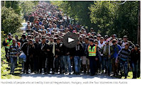 Concepts of Thinking: Geographic Perspective, Patterns and Trends,
Spatial Significance
Create a spatial journal to determine:
Concepts of Thinking: Geographic Perspective, Patterns and Trends,
Spatial Significance
Create a spatial journal to determine:
What Is Where? and discuss Why There?
BBC News Middle EastSyria profile - Timeline15 September 2015Middle East
 Concepts of Thinking: Patterns and Trends, Geographic Perspective, Spatial SignificanceCreate a spatial journal/time line of events to help analyse contributing factors (Concepts of Thinking) of this issue to help determine a possible solution. Aleppo, along with Damascus, is one of the oldest continuously inhabited cities
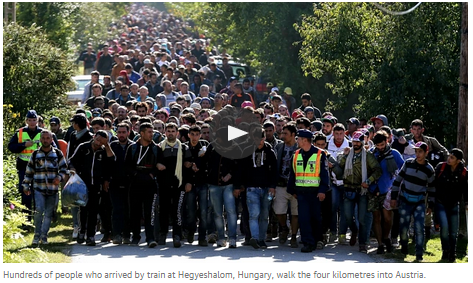
What Is Where? and discuss Why There?

Central Europe gives up on holding refugees back from Austria
HUNGARY, SLOVENIA AND CROATIA ABANDON ATTEMPTS TO BLOCK PASSAGE OF MIGRANTS TO AUSTRIA WHILE EU STRUGGLES TO FIND LASTING POLITICAL SOLUTION

CONCEPTS OF THINKING: GEOGRAPHIC PERSPECTIVE, SPATIAL SIGNIFICANCE, PATTERNS AND TRENDS
OVER 200 SYRIANS AND IRAQIS SAVED BY TURKISH COASTGUARDS ALLEGEDLY THREATENED WITH DEPORTATION BACK TO WAR ZONES. PHOTOGRAPH: UMIT BEKTAS/REUTER
GLOBE LEADERS’ DEBATE
Harper, Mulcair, Trudeau lock horns over sluggish economy
The Globe and Mail
Published
Last updated
 Concepts of Thinking: Geographic Perspective, Spatial Significance
Lesson idea: How might location impact a voters view on an issue? Map it out. What are some of the patterns that emerge? Can you make a prediction on the out come of the election at this point? Continue following the election.
Extension: create a spatial journal of where the politicians have campaigned.
The Globe and Mail
Published
Last updated
Chile's quick response to quake kept death toll down
Speedy, orderly evacuation of more than one million people after Wednesday's 8.3-magnitude earthquake shows how effective early warning systems and disaster-preparedness plans can be.

Concepts of Thinking: Patterns and Trends, Interrelationships, Spatial Significance
A man sits by fishing boats that were run aground by the sea while berthed in the port of Coquimbo, about 445 kilometres north of Santiago, Chile, during the earthquake Wednesday night.
By: Marina Jimenez Toronto Star, Published on Thu Sep 17 2015

Mississauga mayor leads charge to raise $5M for Syrian refugees

Concepts of Thinking:
Geographic Perspective
Geography definition: What is Where? Why Care?

Clashes with police follow moves by desperate refugees to break through a border gate, as others make their way to Croatia
Concepts of Thinking: Geographic Perspective, Patterns and Trends, Spatial Significance, Interrelationships


Chile earthquake: one million people evacuated after 8.3 magnitude quake – live updates
Waves of up to 4.5m high reported in some parts of Chile as tsunami warning issued for Peru, Chile, New Zealand, California and Hawaii
Concepts of Thinking: Spatial Significance, Geographic Perspective, Patterns and Trends

Roméo Dallaire says Canada could take 90,000 Syrian refugees
Syrians would be 'an incredible asset' to Canada, says former UN commander and retired senator
By Jennifer Chevalier, CBC News Posted: Sep 14, 2015 9:13 PM ET Last Updated: Sep 14, 2015 9:13 PM ET
 Concepts of Thinking: Geographic Perspective, Interrelationships, Patterns and Trends
By Jennifer Chevalier, CBC News Posted: Sep 14, 2015 9:13 PM ET Last Updated: Sep 14, 2015 9:13 PM ET
 Concepts of Thinking: Geographic Perspective, Interrelationships, Patterns and Trends
Refugees scramble for ways into Europe as Hungary seals borders
Rumours and confusion grow as European leaders show little will to manage large numbers of people fleeing traumas of war
 Concepts of Think: Spatial Significance, Geographic Perspective, Patterns and Trends, Interrelationships

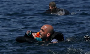


No comments:
Post a Comment